Pana night lights from space
Night Light of Pana (Illinois) from space (United States) Src. Average luminocity for 10x10km area is 10.6616% and for 50x50km: 2.5961%.
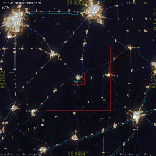
Analysis of Pana night lights 2016
Square area 10x10 km:
 0.34%
0.34%90-99
1.36%80-89
1.02%70-79
0.34%60-69
2.04%50-59
3.23%40-49
2.21%30-39
3.57%20-29
1.53%10-19
0%0-9
84.35%Square area 50x50 km:
0.21%90-99
0.35%80-89
0.37%70-79
0.25%60-69
0.45%50-59
0.35%40-49
0.38%30-39
0.52%20-29
0.37%10-19
1.15%0-9
95.59%Clear (daylight) street map image can be seen on geolist.org.
Map coordinates:
39° 55' 48.8" North, 89° 46' 59.6" West
39° 23' 20.1" North, 89° 4' 48.3" West
38° 50' 36.2" North, 88° 22' 37.1" West
Some cities around Pana sort by population:
• Decatur
51.3 km =31.9 mi,  12°
12°
• Mattoon
61.6 km =38.3 mi,  80°
80°
• Effingham
55 km =34.2 mi,  122°
122°
• Taylorville
25.6 km =15.9 mi,  314°
314°
• Vandalia
47.6 km =29.6 mi,  181°
181°
• Litchfield
54.8 km =34.1 mi,  244°
244°
• Mount Zion
46 km =28.6 mi,  22°
22°
• Hillsboro
43.8 km =27.2 mi,  234°
234°
4246595 (p: 5,607)
Sources (retrieved 2019-11-25):
» Earth at Night: Flat Maps 2012, 2016