Spring Hill night lights from space
Night Light of Spring Hill (Florida) from space (United States) Src. Average luminocity for 10x10km area is 75.8968% and for 50x50km: 26.3867%.
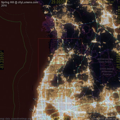
Analysis of Spring Hill night lights 2016
Square area 10x10 km:
 7.34%
7.34%90-99
9.13%80-89
15.67%70-79
27.18%60-69
39.09%50-59
1.59%40-49
0%30-39
0%20-29
0%10-19
0%0-9
0%Square area 50x50 km:
1.74%90-99
2.41%80-89
1.91%70-79
3.38%60-69
11.81%50-59
5.35%40-49
3.62%30-39
4.56%20-29
7.29%10-19
12.93%0-9
44.99%Clear (daylight) street map image can be seen on geolist.org.
Map coordinates:
29° 5' 35.2" North, 83° 13' 42.9" West
28° 28' 36.8" North, 82° 31' 31.7" West
27° 51' 25.3" North, 81° 49' 20.4" West
Some cities around Spring Hill sort by population:
• Bayonet Point
22.8 km =14.2 mi,  222°
222°
• Jasmine Estates
26 km =16.2 mi, 218°
• Hudson
20.6 km =12.8 mi,  232°
232°
• Shady Hills
7.6 km =4.7 mi,  192°
192°
• North Weeki Wachee
8.8 km =5.5 mi,  338°
338°
• Sugarmill Woods
28.5 km =17.7 mi,  3°
3°
• Brooksville
15.9 km =9.9 mi,  56°
56°
• Timber Pines
7.6 km =4.7 mi,  264°
264°
4173838 (p: 98,621)
Sources (retrieved 2019-11-25):
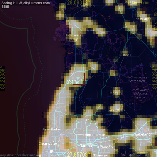
» NASA, Earths city lights 1995
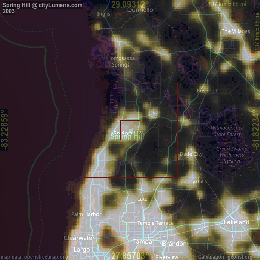
» NASA city lights 2003
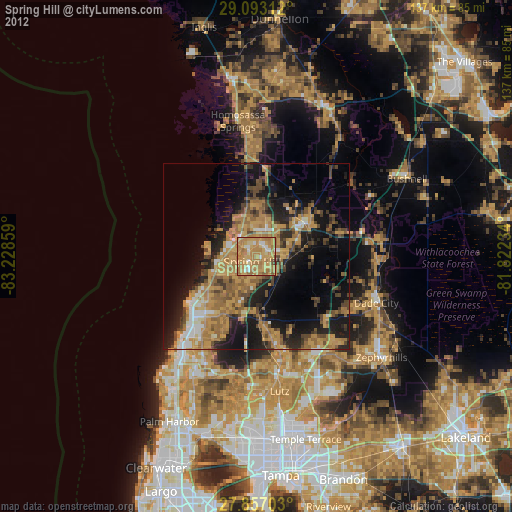
» Earth at Night: Flat Maps 2012, 2016