Bayonet Point night lights from space
Night Light of Bayonet Point (Florida) from space (United States) Src. Average luminocity for 10x10km area is 72.5377% and for 50x50km: 34.7676%.
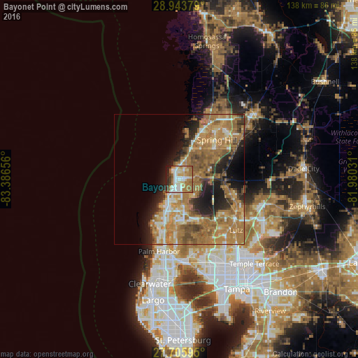
Analysis of Bayonet Point night lights 2016
Square area 10x10 km:
 13.1%
13.1%90-99
20.63%80-89
9.72%70-79
9.33%60-69
23.81%50-59
6.75%40-49
3.77%30-39
3.77%20-29
7.14%10-19
1.98%0-9
0%Square area 50x50 km:
3.02%90-99
4.32%80-89
3.66%70-79
7.06%60-69
16.09%50-59
5.51%40-49
3.84%30-39
3.27%20-29
5.99%10-19
8.32%0-9
38.92%Clear (daylight) street map image can be seen on geolist.org.
Map coordinates:
28° 56' 37.6" North, 83° 23' 11.6" West
28° 19' 36" North, 82° 41' 0.3" West
27° 42' 21.4" North, 81° 58' 49.1" West
Some cities around Bayonet Point sort by population:
• Holiday
16.4 km =10.2 mi,  199°
199°
• Jasmine Estates
3.8 km =2.4 mi,  189°
189°
• New Port Richey
9.8 km =6.1 mi, 200°
• Elfers
12.8 km =8 mi, 197°
• Hudson
4.3 km =2.7 mi,  346°
346°
• Trinity
16.2 km =10.1 mi,  179°
179°
• New Port Richey East
7.4 km =4.6 mi, 186°
• Beacon Square
14.9 km =9.3 mi,  208°
208°
4146901 (p: 23,467)
Sources (retrieved 2019-11-25):
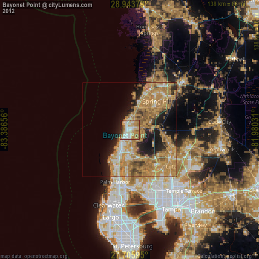
» Earth at Night: Flat Maps 2012, 2016