Southbury night lights from space
Night Light of Southbury (Connecticut) from space (United States) Src. Average luminocity for 10x10km area is 16.1037% and for 50x50km: 25.6556%.
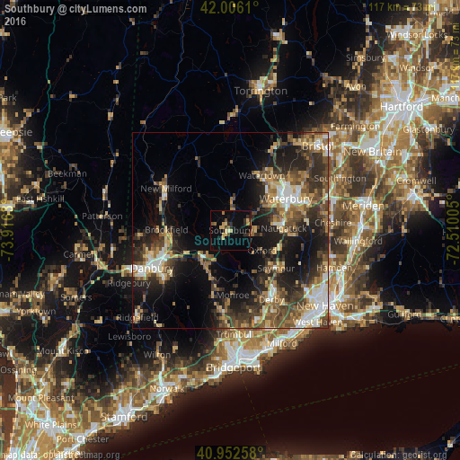
Analysis of Southbury night lights 2016
Square area 10x10 km:
 0%
0%90-99
0.68%80-89
4.76%70-79
2.21%60-69
1.87%50-59
1.53%40-49
1.87%30-39
1.02%20-29
5.1%10-19
5.44%0-9
75.51%Square area 50x50 km:
2.8%90-99
3.33%80-89
3.27%70-79
3.39%60-69
3.78%50-59
4.39%40-49
5.48%30-39
5.51%20-29
8.55%10-19
13.62%0-9
45.88%Clear (daylight) street map image can be seen on geolist.org.
Map coordinates:
42° 0' 22" North, 73° 54' 58.7" West
41° 28' 53.3" North, 73° 12' 47.4" West
40° 57' 9.3" North, 72° 30' 36.2" West
Some cities around Southbury sort by population:
• Waterbury
15.9 km =9.9 mi,  57°
57°
• Naugatuck
13.5 km =8.4 mi,  87°
87°
• Ansonia
18.7 km =11.6 mi,  143°
143°
• Seymour
14.8 km =9.2 mi,  129°
129°
• Oxford
9.6 km =6 mi,  123°
123°
• Woodbury
7 km =4.3 mi,  2°
2°
• Oakville
16.4 km =10.2 mi,  40°
40°
• Middlebury
8.8 km =5.5 mi,  54°
54°
4843362 (p: 19,836)
Sources (retrieved 2019-11-25):
» Earth at Night: Flat Maps 2012, 2016