Oxford night lights from space
Night Light of Oxford (Connecticut) from space (United States) Src. Average luminocity for 10x10km area is 20.4898% and for 50x50km: 33.8264%.
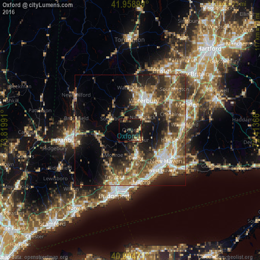
Analysis of Oxford night lights 2016
Square area 10x10 km:
 0.34%
0.34%90-99
0.34%80-89
3.4%70-79
2.21%60-69
3.06%50-59
4.08%40-49
3.91%30-39
1.7%20-29
9.86%10-19
30.95%0-9
40.14%Square area 50x50 km:
3.89%90-99
4.48%80-89
4.47%70-79
4.74%60-69
6.02%50-59
7.24%40-49
7.4%30-39
6.49%20-29
8.69%10-19
12.79%0-9
33.78%Clear (daylight) street map image can be seen on geolist.org.
Map coordinates:
41° 57' 32.4" North, 73° 49' 11.7" West
41° 26' 2.4" North, 73° 7' 0.4" West
40° 54' 17" North, 72° 24' 49.2" West
Some cities around Oxford sort by population:
• Shelton
13.2 km =8.2 mi,  171°
171°
• Naugatuck
8 km =5 mi,  43°
43°
• Southbury
9.6 km =6 mi,  303°
303°
• Ansonia
10.3 km =6.4 mi,  162°
162°
• Seymour
5.4 km =3.4 mi,  140°
140°
• Derby
12.8 km =8 mi, 169°
• Woodbridge
12.8 km =8 mi, 135°
• Middlebury
10.5 km =6.5 mi,  355°
355°
4840237 (p: 11,345)
Sources (retrieved 2019-11-25):
» Earth at Night: Flat Maps 2012, 2016