South San Gabriel night lights from space
Night Light of South San Gabriel (California) from space (United States) Src. Average luminocity for 10x10km area is 96.1731% and for 50x50km: 79.7283%.
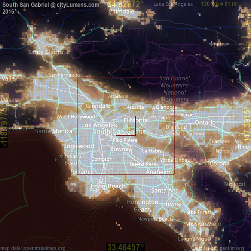
Analysis of South San Gabriel night lights 2016
Square area 10x10 km:
 47.38%
90-99
38.11%80-89
8.74%70-79
5.77%60-69
0%50-59
0%40-49
0%30-39
0%20-29
0%10-19
0%0-9
0%Square area 50x50 km:
42.51%90-99
19.82%80-89
6.14%70-79
7.54%60-69
5.77%50-59
2.7%40-49
1.25%30-39
1.05%20-29
1.56%10-19
3.06%0-9
8.6%Clear (daylight) street map image can be seen on geolist.org.
Map coordinates:
34° 37' 47" North, 118° 47' 51.9" West
34° 2' 56.9" North, 118° 5' 40.6" West
33° 27' 52.5" North, 117° 23' 29.4" West
Some cities around South San Gabriel sort by population:
• El Monte
6.5 km =4 mi,  70°
70°
• Alhambra
5.9 km =3.7 mi,  329°
329°
• Montebello
4.5 km =2.8 mi,  192°
192°
• Monterey Park
3 km =1.9 mi,  299°
299°
• Rosemead
4 km =2.5 mi,  29°
29°
• San Gabriel
5.3 km =3.3 mi,  348°
348°
• Temple City
7.3 km =4.5 mi, 27°
• East San Gabriel
4.7 km =2.9 mi,  3°
3°
5397771 (p: 8,070)
Sources (retrieved 2019-11-25):
» Earth at Night: Flat Maps 2012, 2016