Smithville night lights from space
Night Light of Smithville (New Jersey) from space (United States) Src. Average luminocity for 10x10km area is 21.2776% and for 50x50km: 16.6503%.
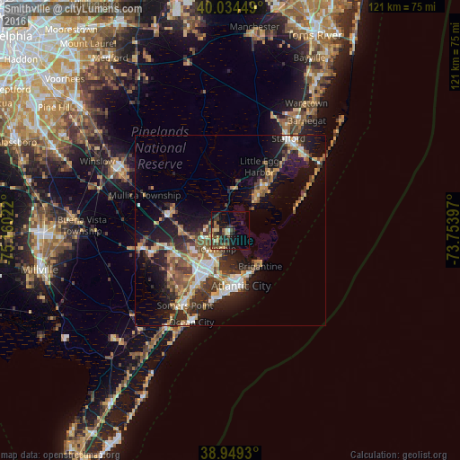
Analysis of Smithville night lights 2016
Square area 10x10 km:
 0.16%
0.16%90-99
1.79%80-89
3.57%70-79
2.44%60-69
1.3%50-59
4.55%40-49
7.47%30-39
5.52%20-29
8.28%10-19
15.26%0-9
49.68%Square area 50x50 km:
2.06%90-99
2.12%80-89
2.14%70-79
2.12%60-69
2.28%50-59
2.79%40-49
2.89%30-39
3.23%20-29
4.78%10-19
11.51%0-9
64.08%Clear (daylight) street map image can be seen on geolist.org.
Map coordinates:
40° 2' 4.2" North, 75° 9' 36.8" West
39° 29' 38.4" North, 74° 27' 25.5" West
38° 56' 57.5" North, 73° 45' 14.3" West
Some cities around Smithville sort by population:
• Atlantic City
14.7 km =9.1 mi,  168°
168°
• Pleasantville
12.9 km =8 mi,  206°
206°
• Ventnor City
17.2 km =10.7 mi,  185°
185°
• Brigantine
12.3 km =7.6 mi,  139°
139°
• Northfield
15.9 km =9.9 mi, 210°
• Mystic Island
8.5 km =5.3 mi,  48°
48°
• Absecon
8 km =5 mi,  204°
204°
• Pomona
10.3 km =6.4 mi,  260°
260°
4504164 (p: 7,242)
Sources (retrieved 2019-11-25):
» Earth at Night: Flat Maps 2012, 2016