Atlantic City night lights from space
Night Light of Atlantic City (New Jersey) from space (United States) Src. Average luminocity for 10x10km area is 43.9745% and for 50x50km: 14.6237%.
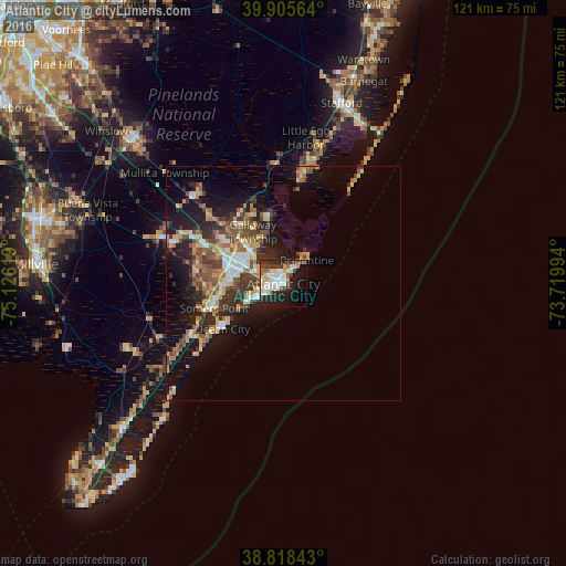
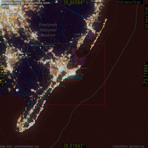
Analysis of Atlantic City night lights 2016
Square area 10x10 km:
 11.56%
90-99
11.56%80-89
3.4%70-79
2.38%60-69
3.4%50-59
3.06%40-49
6.29%30-39
9.01%20-29
13.1%10-19
21.6%0-9
14.63%Square area 50x50 km:
1.78%90-99
1.93%80-89
2.08%70-79
1.74%60-69
2%50-59
2.61%40-49
2.65%30-39
2.74%20-29
4.13%10-19
9.63%0-9
68.71%Clear (daylight) street map image can be seen on geolist.org.
Map coordinates:
39° 54' 20.3" North, 75° 7' 34.3" West
39° 21' 50.9" North, 74° 25' 23" West
38° 49' 6.3" North, 73° 43' 11.8" West
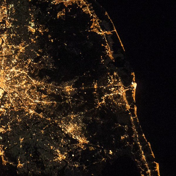
Fantastic image of Atlantic City from space taken by astronauts [src2], but I don't have information about it's orientation, scale or angle. If necessary, it was rotated manually, so North points approximately to upper direction. Click to zoom in:
Some cities around Atlantic City sort by population:
• Pleasantville
9.1 km =5.7 mi,  288°
288°
• Ventnor City
5.4 km =3.4 mi,  240°
240°
• Brigantine
7.2 km =4.5 mi,  44°
44°
• Northfield
10.9 km =6.8 mi,  273°
273°
• Absecon
9.5 km =5.9 mi,  318°
318°
• Smithville
14.7 km =9.1 mi,  348°
348°
• Linwood
13.4 km =8.3 mi,  258°
258°
• Margate City
8 km =5 mi, 239°
4500546 (p: 39,260)
Sources (retrieved 2019-11-25):
» Earth at Night: Flat Maps 2012, 2016
Src.2: Shane Kimbrough Twitter@astro_kimbroughĀĀ2017-01-11