Shoreview night lights from space
Night Light of Shoreview (Minnesota) from space (United States) Src. Average luminocity for 10x10km area is 64.7424% and for 50x50km: 54.5815%.
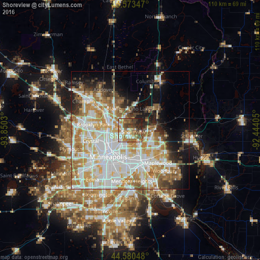
Analysis of Shoreview night lights 2016
Square area 10x10 km:
 12.12%
90-99
11.67%80-89
5.76%70-79
10.91%60-69
19.09%50-59
10.91%40-49
11.82%30-39
7.42%20-29
7.73%10-19
2.58%0-9
0%Square area 50x50 km:
16.78%90-99
13.65%80-89
6.2%70-79
7.06%60-69
8.32%50-59
4.96%40-49
4.43%30-39
2.97%20-29
4.86%10-19
8.47%0-9
22.29%Clear (daylight) street map image can be seen on geolist.org.
Map coordinates:
45° 34' 24.5" North, 93° 51' 1.1" West
45° 4' 44.9" North, 93° 8' 49.8" West
44° 34' 49.7" North, 92° 26' 38.6" West
Some cities around Shoreview sort by population:
• Roseville
8.2 km =5.1 mi,  185°
185°
• New Brighton
4.6 km =2.9 mi,  250°
250°
• Vadnais Heights
6.2 km =3.9 mi,  112°
112°
• Mounds View
5.6 km =3.5 mi,  300°
300°
• Little Canada
7.5 km =4.7 mi,  141°
141°
• Arden Hills
3.3 km =2.1 mi, 192°
• Saint Anthony
8.6 km =5.3 mi,  220°
220°
• Spring Lake Park
7.8 km =4.8 mi,  294°
294°
5047234 (p: 26,477)
Sources (retrieved 2019-11-25):
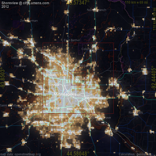
» Earth at Night: Flat Maps 2012, 2016