Arden Hills night lights from space
Night Light of Arden Hills (Minnesota) from space (United States) Src. Average luminocity for 10x10km area is 78.6788% and for 50x50km: 59.2713%.
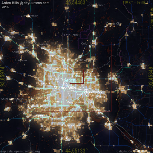
Analysis of Arden Hills night lights 2016
Square area 10x10 km:
 20.76%
90-99
20.61%80-89
9.09%70-79
14.24%60-69
18.64%50-59
6.52%40-49
6.67%30-39
1.67%20-29
1.82%10-19
0%0-9
0%Square area 50x50 km:
17.74%90-99
14.63%80-89
6.77%70-79
8.04%60-69
10.06%50-59
5.76%40-49
4.71%30-39
3.13%20-29
4.88%10-19
8.07%0-9
16.2%Clear (daylight) street map image can be seen on geolist.org.
Map coordinates:
45° 32' 41.4" North, 93° 51' 35.1" West
45° 3' 0.9" North, 93° 9' 23.8" West
44° 33' 4.8" North, 92° 27' 12.6" West
Some cities around Arden Hills sort by population:
• Roseville
4.9 km =3 mi,  180°
180°
• Shoreview
3.3 km =2.1 mi,  12°
12°
• New Brighton
3.9 km =2.4 mi,  295°
295°
• Vadnais Heights
6.6 km =4.1 mi,  82°
82°
• Mounds View
7.3 km =4.5 mi,  326°
326°
• Little Canada
6 km =3.7 mi,  115°
115°
• Saint Anthony
5.8 km =3.6 mi,  235°
235°
• Falcon Heights
6.6 km =4.1 mi,  186°
186°
5016553 (p: 9,951)
Sources (retrieved 2019-11-25):
» Earth at Night: Flat Maps 2012, 2016