Mounds View night lights from space
Night Light of Mounds View (Minnesota) from space (United States) Src. Average luminocity for 10x10km area is 79.7303% and for 50x50km: 53.8444%.
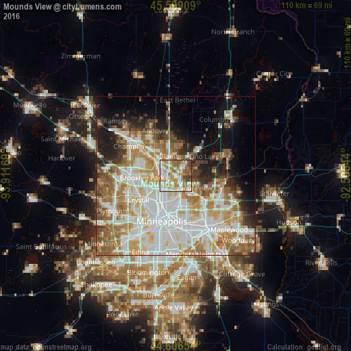
Analysis of Mounds View night lights 2016
Square area 10x10 km:
 19.85%
90-99
21.82%80-89
10.61%70-79
14.7%60-69
15.15%50-59
10%40-49
6.36%30-39
1.52%20-29
0%10-19
0%0-9
0%Square area 50x50 km:
15.78%90-99
12.69%80-89
6.17%70-79
7.15%60-69
8.66%50-59
6.06%40-49
4.67%30-39
3.21%20-29
5.08%10-19
8.87%0-9
21.65%Clear (daylight) street map image can be seen on geolist.org.
Map coordinates:
45° 35' 56.7" North, 93° 54' 42.1" West
45° 6' 17.9" North, 93° 12' 30.8" West
44° 36' 23.5" North, 92° 30' 19.6" West
Some cities around Mounds View sort by population:
• Coon Rapids
6.4 km =4 mi,  285°
285°
• Blaine
6.5 km =4 mi,  341°
341°
• Fridley
4.8 km =3 mi,  243°
243°
• Shoreview
5.6 km =3.5 mi,  120°
120°
• New Brighton
4.4 km =2.7 mi,  173°
173°
• Columbia Heights
8.3 km =5.2 mi,  210°
210°
• Arden Hills
7.3 km =4.5 mi,  146°
146°
• Spring Lake Park
2.3 km =1.4 mi,  277°
277°
5038373 (p: 12,914)
Sources (retrieved 2019-11-25):
» Earth at Night: Flat Maps 2012, 2016