Shiprock night lights from space
Night Light of Shiprock (New Mexico) from space (United States) Src. Average luminocity for 10x10km area is 25.1469% and for 50x50km: 1.9032%.
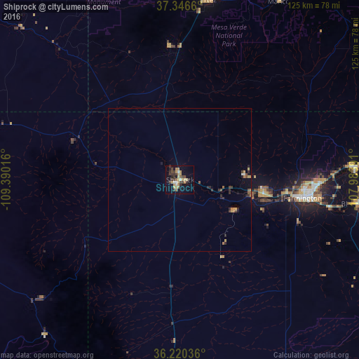
Analysis of Shiprock night lights 2016
Square area 10x10 km:
 1.4%
1.4%90-99
2.1%80-89
4.2%70-79
5.59%60-69
3.5%50-59
2.27%40-49
5.59%30-39
6.99%20-29
3.32%10-19
17.83%0-9
47.2%Square area 50x50 km:
0.09%90-99
0.1%80-89
0.28%70-79
0.31%60-69
0.29%50-59
0.23%40-49
0.37%30-39
0.47%20-29
0.44%10-19
0.91%0-9
96.5%Clear (daylight) street map image can be seen on geolist.org.
Map coordinates:
37° 20' 47.8" North, 109° 23' 24.6" West
36° 47' 8" North, 108° 41' 13.3" West
36° 13' 13.3" North, 107° 59' 2.1" West
Some cities around Shiprock sort by population:
• Farmington
42.2 km =26.2 mi,  98°
98°
• Durango
90 km =55.9 mi,  52°
52°
• Cortez
63.3 km =39.3 mi,  8°
8°
• Kirtland
29.7 km =18.5 mi, 101°
• Bloomfield
63.1 km =39.2 mi, 97°
• Aztec
61.9 km =38.5 mi,  86°
86°
• Lee Acres
58.7 km =36.5 mi, 99°
• Kayenta
139.8 km =86.9 mi,  267°
267°
5491288 (p: 8,295)
Sources (retrieved 2019-11-25):
» Earth at Night: Flat Maps 2012, 2016