Kirtland night lights from space
Night Light of Kirtland (New Mexico) from space (United States) Src. Average luminocity for 10x10km area is 24.8514% and for 50x50km: 6.2838%.
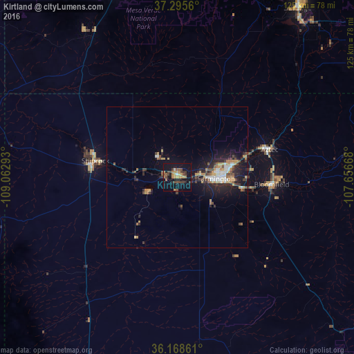
Analysis of Kirtland night lights 2016
Square area 10x10 km:
 0.7%
0.7%90-99
0.7%80-89
2.62%70-79
6.82%60-69
4.2%50-59
3.85%40-49
6.82%30-39
4.37%20-29
2.97%10-19
33.39%0-9
33.57%Square area 50x50 km:
0.64%90-99
0.73%80-89
0.54%70-79
1.24%60-69
0.79%50-59
0.64%40-49
1.2%30-39
0.87%20-29
1.98%10-19
5.53%0-9
85.84%Clear (daylight) street map image can be seen on geolist.org.
Map coordinates:
37° 17' 44.2" North, 109° 3' 46.5" West
36° 44' 3" North, 108° 21' 35.3" West
36° 10' 7" North, 107° 39' 24" West
Some cities around Kirtland sort by population:
• Farmington
12.6 km =7.8 mi,  93°
93°
• Gallup
138.4 km =86 mi,  194°
194°
• Durango
73.7 km =45.8 mi,  35°
35°
• Cortez
71.2 km =44.2 mi,  343°
343°
• Shiprock
29.7 km =18.5 mi,  281°
281°
• Bloomfield
33.5 km =20.8 mi, 94°
• Aztec
34.1 km =21.2 mi,  73°
73°
• Lee Acres
29.1 km =18.1 mi,  97°
97°
5474539 (p: 7,875)
Sources (retrieved 2019-11-25):
» Earth at Night: Flat Maps 2012, 2016