Lee Acres night lights from space
Night Light of Lee Acres (New Mexico) from space (United States) Src. Average luminocity for 10x10km area is 15.2509% and for 50x50km: 6.5424%.
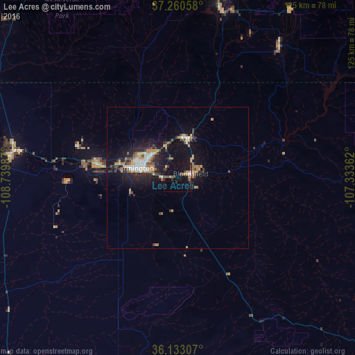
Analysis of Lee Acres night lights 2016
Square area 10x10 km:
 0.92%
0.92%90-99
0.55%80-89
0%70-79
4.4%60-69
1.47%50-59
2.2%40-49
4.95%30-39
3.66%20-29
0.37%10-19
12.45%0-9
69.05%Square area 50x50 km:
0.7%90-99
0.83%80-89
0.36%70-79
1.36%60-69
0.93%50-59
0.55%40-49
1.18%30-39
0.93%20-29
1.77%10-19
5.59%0-9
85.8%Clear (daylight) street map image can be seen on geolist.org.
Map coordinates:
37° 15' 38.1" North, 108° 44' 23.5" West
36° 41' 56" North, 108° 2' 12.3" West
36° 7' 59.1" North, 107° 20' 1" West
Some cities around Lee Acres sort by population:
• Farmington
16.5 km =10.3 mi,  281°
281°
• Gallup
144.8 km =90 mi,  205°
205°
• Durango
65.6 km =40.8 mi,  12°
12°
• Cortez
87.2 km =54.2 mi,  325°
325°
• Shiprock
58.7 km =36.5 mi, 279°
• Kirtland
29.1 km =18.1 mi, 277°
• Bloomfield
4.9 km =3 mi,  73°
73°
• Aztec
14.3 km =8.9 mi,  15°
15°
5475668 (p: 5,858)
Sources (retrieved 2019-11-25):
» Earth at Night: Flat Maps 2012, 2016