Shady Side night lights from space
Night Light of Shady Side (Maryland) from space (United States) Src. Average luminocity for 10x10km area is 14.5595% and for 50x50km: 21.1536%.
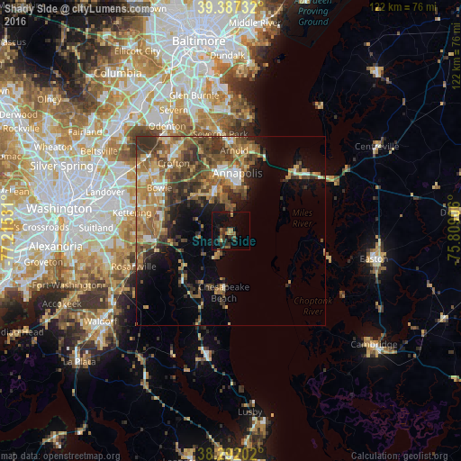
Analysis of Shady Side night lights 2016
Square area 10x10 km:
 0%
0%90-99
0%80-89
1.7%70-79
0.85%60-69
4.93%50-59
1.7%40-49
0.34%30-39
6.97%20-29
3.74%10-19
16.84%0-9
62.93%Square area 50x50 km:
1.69%90-99
2.12%80-89
2.86%70-79
3.99%60-69
3.94%50-59
5.21%40-49
4.64%30-39
4.94%20-29
3.48%10-19
6.67%0-9
60.47%Clear (daylight) street map image can be seen on geolist.org.
Map coordinates:
39° 23' 14.4" North, 77° 12' 55.1" West
38° 50' 30.4" North, 76° 30' 43.8" West
38° 17' 31.3" North, 75° 48' 32.6" West
Some cities around Shady Side sort by population:
• Annapolis
15.3 km =9.5 mi,  6°
6°
• Parole
15.4 km =9.6 mi,  354°
354°
• Edgewater
13.2 km =8.2 mi, 345°
• Mayo
5.1 km =3.2 mi,  0°
0°
• Londontowne
10.7 km =6.6 mi,  342°
342°
• Davidsonville
13.5 km =8.4 mi,  311°
311°
• Chesapeake Beach
17.4 km =10.8 mi,  186°
186°
• Robinwood
12.5 km =7.8 mi,  359°
359°
4369286 (p: 5,803)
Sources (retrieved 2019-11-25):
» Earth at Night: Flat Maps 2012, 2016