Robinwood night lights from space
Night Light of Robinwood (Maryland) from space (United States) Src. Average luminocity for 10x10km area is 65.2662% and for 50x50km: 31.8178%.
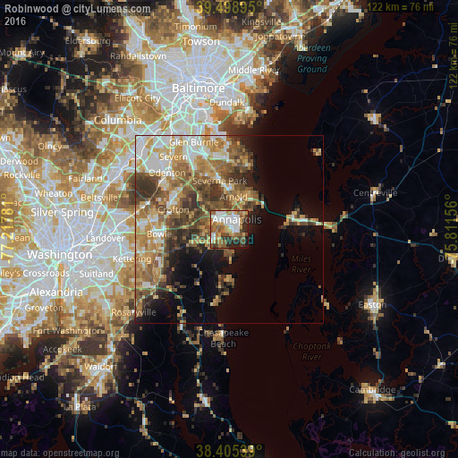
Analysis of Robinwood night lights 2016
Square area 10x10 km:
 14.45%
90-99
14.12%80-89
5.84%70-79
11.2%60-69
9.58%50-59
15.1%40-49
8.28%30-39
7.14%20-29
9.9%10-19
4.22%0-9
0.16%Square area 50x50 km:
4.36%90-99
5.29%80-89
4.39%70-79
5.78%60-69
5.74%50-59
6.78%40-49
5.19%30-39
5.41%20-29
3.86%10-19
6.84%0-9
46.36%Clear (daylight) street map image can be seen on geolist.org.
Map coordinates:
39° 29' 56.2" North, 77° 13' 4.1" West
38° 57' 15.4" North, 76° 30' 52.8" West
38° 24' 19.4" North, 75° 48' 41.6" West
Some cities around Robinwood sort by population:
• Annapolis
3.3 km =2.1 mi,  36°
36°
• Arnold
8.7 km =5.4 mi,  6°
6°
• Parole
3.1 km =1.9 mi,  334°
334°
• Edgewater
3.1 km =1.9 mi,  275°
275°
• Cape Saint Claire
11.6 km =7.2 mi,  31°
31°
• Mayo
7.4 km =4.6 mi,  178°
178°
• Londontowne
3.8 km =2.4 mi,  232°
232°
• Davidsonville
10.4 km =6.5 mi,  250°
250°
4367034 (p: 5,024)
Sources (retrieved 2019-11-25):
» Earth at Night: Flat Maps 2012, 2016