Annapolis night lights from space
Night Light of Annapolis (Maryland) from space (United States) Src. Average luminocity for 10x10km area is 61.664% and for 50x50km: 31.9459%.
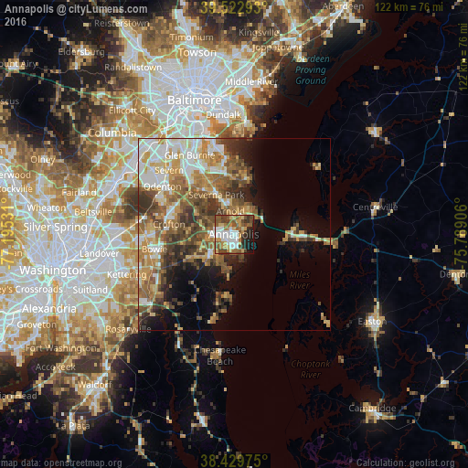
Analysis of Annapolis night lights 2016
Square area 10x10 km:
 11.85%
90-99
11.2%80-89
7.79%70-79
12.01%60-69
7.31%50-59
14.61%40-49
11.53%30-39
6.49%20-29
8.12%10-19
8.12%0-9
0.97%Square area 50x50 km:
4.89%90-99
5.91%80-89
4.19%70-79
5.39%60-69
5.44%50-59
6.4%40-49
5.05%30-39
5.35%20-29
3.92%10-19
6.75%0-9
46.72%Clear (daylight) street map image can be seen on geolist.org.
Map coordinates:
39° 31' 22.5" North, 77° 11' 43.1" West
38° 58' 42.9" North, 76° 29' 30.6" West
38° 25' 47.1" North, 75° 47' 20.6" West
Some cities around Annapolis sort by population:
• Severna Park
11.2 km =7 mi,  335°
335°
• Arnold
6 km =3.7 mi,  350°
350°
• Parole
3.3 km =2.1 mi,  271°
271°
• Edgewater
5.6 km =3.5 mi,  244°
244°
• Cape Saint Claire
8.2 km =5.1 mi,  29°
29°
• Mayo
10.3 km =6.4 mi,  189°
189°
• Londontowne
7.1 km =4.4 mi,  224°
224°
• Robinwood
3.3 km =2.1 mi, 216°
4347242 (p: 39,474)
Sources (retrieved 2019-11-25):
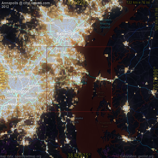
» Earth at Night: Flat Maps 2012, 2016