Selma night lights from space
Night Light of Selma (Alabama) from space (United States) Src. Average luminocity for 10x10km area is 51.8187% and for 50x50km: 4.1371%.
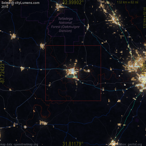
Analysis of Selma night lights 2016
Square area 10x10 km:
 9.71%
9.71%90-99
6.41%80-89
9.34%70-79
11.9%60-69
8.42%50-59
5.31%40-49
3.48%30-39
4.03%20-29
19.23%10-19
21.79%0-9
0.37%Square area 50x50 km:
0.42%90-99
0.28%80-89
0.6%70-79
0.61%60-69
0.7%50-59
0.5%40-49
0.53%30-39
0.64%20-29
1.55%10-19
3.42%0-9
90.76%Clear (daylight) street map image can be seen on geolist.org.
Map coordinates:
32° 59' 56.5" North, 87° 43' 27.2" West
32° 24' 26.5" North, 87° 1' 16" West
31° 48' 42.4" North, 86° 19' 4.7" West
Some cities around Selma sort by population:
• Montgomery
67.9 km =42.2 mi,  93°
93°
• Prattville
53.1 km =33 mi,  83°
83°
• Millbrook
62.4 km =38.8 mi, 82°
• Clanton
60.4 km =37.5 mi,  37°
37°
• Wetumpka
77.4 km =48.1 mi, 78°
• Greenville
74.6 km =46.4 mi,  149°
149°
• Demopolis
77.5 km =48.2 mi,  279°
279°
• Montevallo
78.5 km =48.8 mi,  10°
10°
4089114 (p: 19,519)
Sources (retrieved 2019-11-25):
» Earth at Night: Flat Maps 2012, 2016