Demopolis night lights from space
Night Light of Demopolis (Alabama) from space (United States) Src. Average luminocity for 10x10km area is 25.1886% and for 50x50km: 2.5262%.
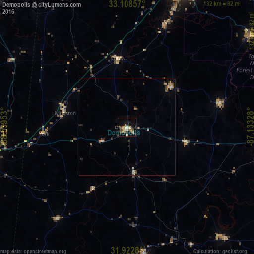
Analysis of Demopolis night lights 2016
Square area 10x10 km:
 1.1%
1.1%90-99
2.56%80-89
5.86%70-79
1.65%60-69
7.33%50-59
3.11%40-49
1.83%30-39
6.78%20-29
2.75%10-19
20.15%0-9
46.89%Square area 50x50 km:
0.06%90-99
0.2%80-89
0.54%70-79
0.28%60-69
0.52%50-59
0.24%40-49
0.39%30-39
0.68%20-29
0.53%10-19
1.21%0-9
95.35%Clear (daylight) street map image can be seen on geolist.org.
Map coordinates:
33° 6' 30.9" North, 88° 32' 22.3" West
32° 31' 3.5" North, 87° 50' 11" West
31° 55' 22.1" North, 87° 7' 59.8" West
Some cities around Demopolis sort by population:
• Tuscaloosa
80.9 km =50.3 mi,  17°
17°
• Meridian
83.1 km =51.6 mi,  258°
258°
• Northport
82.7 km =51.4 mi, 17°
• Selma
77.5 km =48.2 mi,  99°
99°
• Calera
120.3 km =74.8 mi,  57°
57°
• Clanton
118.5 km =73.6 mi,  72°
72°
• Montevallo
111.6 km =69.3 mi,  54°
54°
• Monroeville
120.2 km =74.7 mi,  156°
156°
4058662 (p: 7,148)
Sources (retrieved 2019-11-25):
» Earth at Night: Flat Maps 2012, 2016