Montevallo night lights from space
Night Light of Montevallo (Alabama) from space (United States) Src. Average luminocity for 10x10km area is 24.0641% and for 50x50km: 15.0197%.
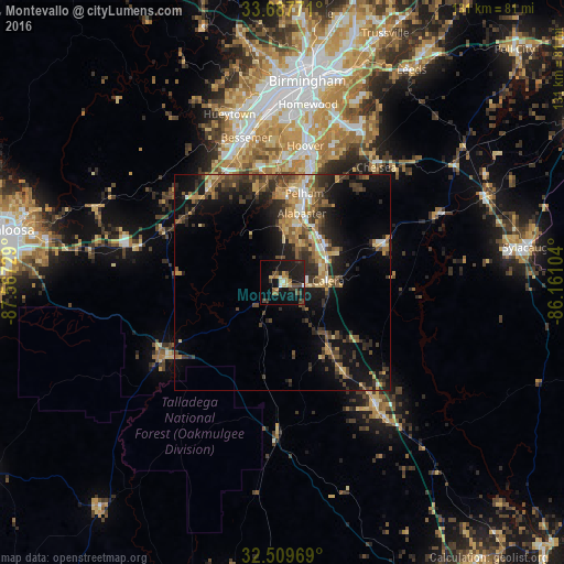
Analysis of Montevallo night lights 2016
Square area 10x10 km:
 0.73%
0.73%90-99
2.01%80-89
3.66%70-79
3.66%60-69
2.2%50-59
2.56%40-49
5.68%30-39
5.86%20-29
5.49%10-19
35.71%0-9
32.42%Square area 50x50 km:
0.83%90-99
1.16%80-89
2%70-79
2.45%60-69
2.52%50-59
2.47%40-49
3.2%30-39
4.06%20-29
4.58%10-19
10.92%0-9
65.8%Clear (daylight) street map image can be seen on geolist.org.
Map coordinates:
33° 41' 15.8" North, 87° 34' 2.2" West
33° 6' 2.4" North, 86° 51' 51" West
32° 30' 34.9" North, 86° 9' 39.7" West
Some cities around Montevallo sort by population:
• Hoover
34.2 km =21.3 mi,  8°
8°
• Alabaster
16.6 km =10.3 mi,  15°
15°
• Bessemer
34.5 km =21.4 mi,  345°
345°
• Pelham
21.2 km =13.2 mi, 13°
• Helena
21.8 km =13.5 mi, 5°
• Calera
10.3 km =6.4 mi,  88°
88°
• Chelsea
34.4 km =21.4 mi,  39°
39°
• Clanton
36.4 km =22.6 mi,  143°
143°
4076771 (p: 6,648)
Sources (retrieved 2019-11-25):
» Earth at Night: Flat Maps 2012, 2016