Millbrook night lights from space
Night Light of Millbrook (Alabama) from space (United States) Src. Average luminocity for 10x10km area is 54.7106% and for 50x50km: 28.1167%.
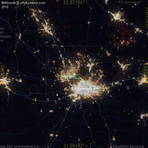
Analysis of Millbrook night lights 2016
Square area 10x10 km:
 2.75%
2.75%90-99
4.4%80-89
13%70-79
11.36%60-69
12.64%50-59
10.44%40-49
12.82%30-39
10.81%20-29
18.32%10-19
3.48%0-9
0%Square area 50x50 km:
4.31%90-99
4.36%80-89
4.02%70-79
3.75%60-69
4.58%50-59
3.14%40-49
4.38%30-39
6.16%20-29
7.71%10-19
14.12%0-9
43.46%Clear (daylight) street map image can be seen on geolist.org.
Map coordinates:
33° 4' 15.7" North, 87° 3' 54.2" West
32° 28' 47.5" North, 86° 21' 42.9" West
31° 53' 5.2" North, 85° 39' 31.7" West
Some cities around Millbrook sort by population:
• Montgomery
13.8 km =8.6 mi,  155°
155°
• Prattville
9.3 km =5.8 mi,  259°
259°
• Selma
62.4 km =38.8 mi, 262°
• Alexander City
64.2 km =39.9 mi,  36°
36°
• Clanton
47.1 km =29.3 mi,  327°
327°
• Tuskegee
63.3 km =39.3 mi,  95°
95°
• Pike Road
32.6 km =20.3 mi,  131°
131°
• Wetumpka
15.8 km =9.8 mi,  63°
63°
4076239 (p: 15,314)
Sources (retrieved 2019-11-25):
» Earth at Night: Flat Maps 2012, 2016