Seaford night lights from space
Night Light of Seaford (New York) from space (United States) Src. Average luminocity for 10x10km area is 75.2776% and for 50x50km: 49.2568%.
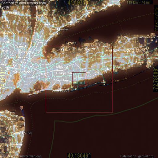
Analysis of Seaford night lights 2016
Square area 10x10 km:
 33.28%
90-99
25.65%80-89
5.36%70-79
0.65%60-69
2.92%50-59
2.6%40-49
4.38%30-39
9.74%20-29
11.2%10-19
4.22%0-9
0%Square area 50x50 km:
18.96%90-99
12.1%80-89
5.33%70-79
6.19%60-69
5.28%50-59
4.14%40-49
2.3%30-39
2.41%20-29
4.53%10-19
3.9%0-9
34.87%Clear (daylight) street map image can be seen on geolist.org.
Map coordinates:
41° 11' 49.7" North, 74° 11' 28.7" West
40° 39' 57.3" North, 73° 29' 17.4" West
40° 7' 49.7" North, 72° 47' 6.2" West
Some cities around Seaford sort by population:
• Massapequa
2 km =1.2 mi,  35°
35°
• North Bellmore
4.8 km =3 mi,  306°
306°
• East Massapequa
4.4 km =2.7 mi,  79°
79°
• Wantagh
2.7 km =1.7 mi,  316°
316°
• North Massapequa
4.5 km =2.8 mi,  29°
29°
• Massapequa Park
3.2 km =2 mi,  60°
60°
• Bellmore
3.3 km =2.1 mi,  275°
275°
• North Wantagh
3.5 km =2.2 mi,  331°
331°
5137507 (p: 15,294)
Sources (retrieved 2019-11-25):
» Earth at Night: Flat Maps 2012, 2016