Savannah night lights from space
Night Light of Savannah (Missouri) from space (United States) Src. Average luminocity for 10x10km area is 9.0986% and for 50x50km: 5.9636%.
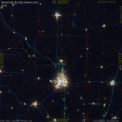
Analysis of Savannah night lights 2016
Square area 10x10 km:
 0.51%
0.51%90-99
0.51%80-89
1.19%70-79
1.87%60-69
0.17%50-59
1.87%40-49
2.38%30-39
2.21%20-29
2.04%10-19
1.53%0-9
85.71%Square area 50x50 km:
0.98%90-99
1.15%80-89
0.73%70-79
0.69%60-69
1.07%50-59
0.8%40-49
0.67%30-39
0.97%20-29
1.2%10-19
2.65%0-9
89.08%Clear (daylight) street map image can be seen on geolist.org.
Map coordinates:
40° 28' 43" North, 95° 32' 0.2" West
39° 56' 30" North, 94° 49' 48.9" West
39° 24' 1.6" North, 94° 7' 37.7" West
Some cities around Savannah sort by population:
• Saint Joseph
19.3 km =12 mi,  184°
184°
• Leavenworth
70.6 km =43.9 mi,  186°
186°
• Maryville
45.1 km =28 mi,  355°
355°
• Lansing
77.3 km =48 mi, 184°
• Atchison
48.9 km =30.4 mi,  210°
210°
• Cameron
55.1 km =34.2 mi,  113°
113°
• Kearney
75.3 km =46.8 mi,  147°
147°
• Smithville
65.3 km =40.6 mi,  160°
160°
4407665 (p: 5,108)
Sources (retrieved 2019-11-25):
» Earth at Night: Flat Maps 2012, 2016