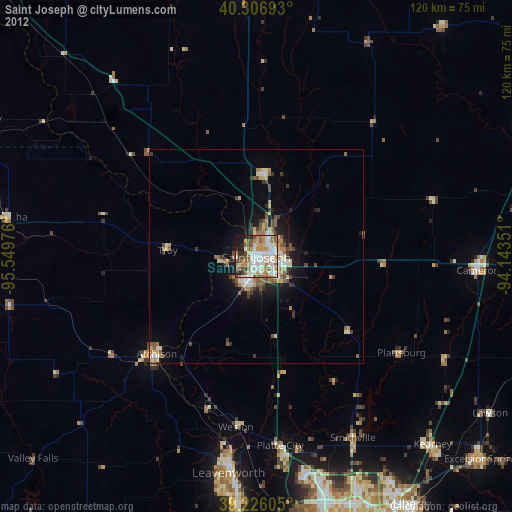
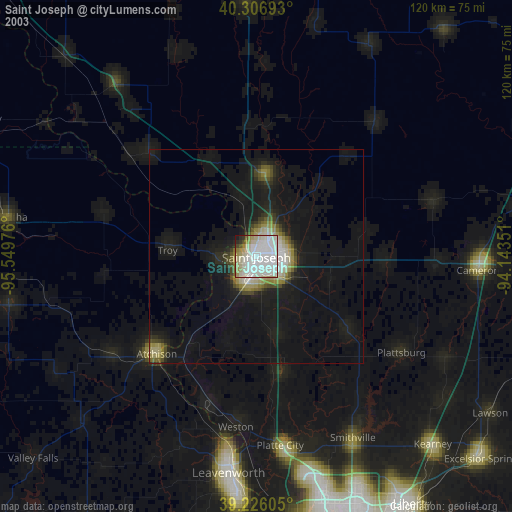
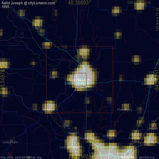
Saint Joseph night lights from space
Night Light of Saint Joseph (Missouri) from space (United States) Src. Average luminocity for 10x10km area is 70.3827% and for 50x50km: 7.3282%.

Analysis of Saint Joseph night lights 2016
Square area 10x10 km:
 18.54%
90-99
20.24%80-89
7.99%70-79
7.31%60-69
12.76%50-59
8.84%40-49
3.91%30-39
7.82%20-29
7.48%10-19
4.93%0-9
0.17%Square area 50x50 km:
1.05%90-99
1.33%80-89
0.88%70-79
0.83%60-69
1.33%50-59
0.87%40-49
0.84%30-39
1.26%20-29
1.69%10-19
4.06%0-9
85.85%Clear (daylight) street map image can be seen on geolist.org.
Map coordinates:
40° 18' 24.9" North, 95° 32' 59.1" West
39° 46' 7" North, 94° 50' 47.9" West
39° 13' 33.8" North, 94° 8' 36.6" West
Some cities around Saint Joseph sort by population:
• Leavenworth
51.3 km =31.9 mi,  187°
187°
• Maryville
64.2 km =39.9 mi,  358°
358°
• Lansing
58 km =36 mi,  184°
184°
• Atchison
32.8 km =20.4 mi,  225°
225°
• Cameron
51.9 km =32.2 mi,  93°
93°
• Kearney
60.9 km =37.8 mi,  137°
137°
• Smithville
48.2 km =30 mi,  151°
151°
• Savannah
19.3 km =12 mi,  4°
4°
4407010 (p: 76,780)
Sources (retrieved 2019-11-25):
» NASA, Earths city lights 1995
» NASA city lights 2003
» Earth at Night: Flat Maps 2012, 2016