Cameron night lights from space
Night Light of Cameron (Missouri) from space (United States) Src. Average luminocity for 10x10km area is 16.9854% and for 50x50km: 1.5901%.
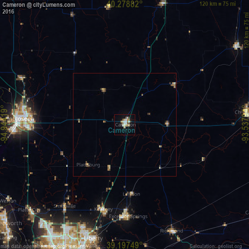
Analysis of Cameron night lights 2016
Square area 10x10 km:
 2.44%
2.44%90-99
2.76%80-89
3.25%70-79
1.3%60-69
2.27%50-59
2.11%40-49
1.62%30-39
1.46%20-29
0.32%10-19
7.79%0-9
74.68%Square area 50x50 km:
0.1%90-99
0.19%80-89
0.32%70-79
0.13%60-69
0.38%50-59
0.24%40-49
0.23%30-39
0.24%20-29
0.24%10-19
0.45%0-9
97.49%Clear (daylight) street map image can be seen on geolist.org.
Map coordinates:
40° 16' 43.8" North, 94° 56' 39.1" West
39° 44' 25" North, 94° 14' 27.8" West
39° 11' 51" North, 93° 32' 16.6" West
Some cities around Cameron sort by population:
• Saint Joseph
51.9 km =32.2 mi,  273°
273°
• Liberty
57 km =35.4 mi,  195°
195°
• Excelsior Springs
44.6 km =27.7 mi,  178°
178°
• Chillicothe
59.2 km =36.8 mi,  84°
84°
• Kearney
42.7 km =26.5 mi,  194°
194°
• Smithville
48.9 km =30.4 mi,  216°
216°
• Richmond
56.1 km =34.9 mi,  156°
156°
• Savannah
55.1 km =34.2 mi,  293°
293°
4379644 (p: 9,836)
Sources (retrieved 2019-11-25):
» Earth at Night: Flat Maps 2012, 2016