San Mateo night lights from space
Night Light of San Mateo (California) from space (United States) Src. Average luminocity for 10x10km area is 65.5227% and for 50x50km: 34.6112%.
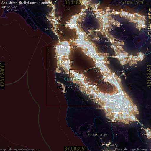
Analysis of San Mateo night lights 2016
Square area 10x10 km:
 15.26%
90-99
18.99%80-89
5.84%70-79
8.12%60-69
7.79%50-59
10.55%40-49
9.74%30-39
5.52%20-29
12.18%10-19
6.01%0-9
0%Square area 50x50 km:
8.97%90-99
7.91%80-89
1.82%70-79
4.11%60-69
4.89%50-59
5.04%40-49
3.84%30-39
3.94%20-29
8.27%10-19
11.17%0-9
40.05%Clear (daylight) street map image can be seen on geolist.org.
Map coordinates:
38° 7' 5.7" North, 123° 1' 43.2" West
37° 33' 46.8" North, 122° 19' 31.9" West
37° 0' 12.8" North, 121° 37' 20.7" West
Some cities around San Mateo sort by population:
• San Bruno
10.6 km =6.6 mi,  314°
314°
• Foster City
4.8 km =3 mi,  95°
95°
• Burlingame
4.3 km =2.7 mi,  303°
303°
• San Carlos
8.4 km =5.2 mi,  137°
137°
• Belmont
6.5 km =4 mi, 137°
• Millbrae
6.7 km =4.2 mi, 306°
• Hillsborough
4.9 km =3 mi,  284°
284°
• Redwood Shores
7.7 km =4.8 mi,  116°
116°
5392423 (p: 103,536)
Sources (retrieved 2019-11-25):
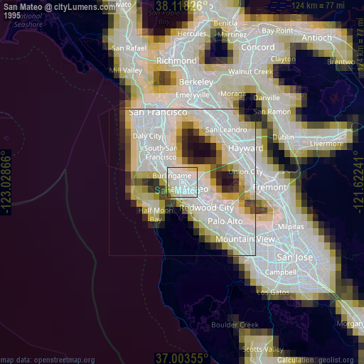
» NASA, Earths city lights 1995
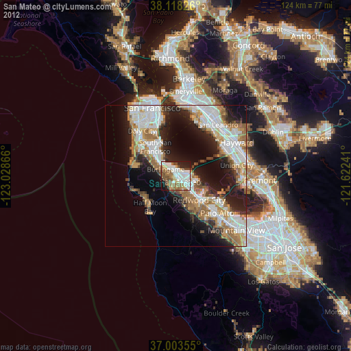
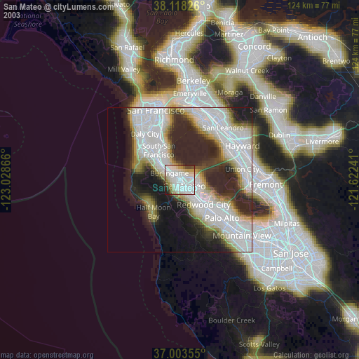
» NASA city lights 2003
» Earth at Night: Flat Maps 2012, 2016