Millbrae night lights from space
Night Light of Millbrae (California) from space (United States) Src. Average luminocity for 10x10km area is 57.5476% and for 50x50km: 32.2519%.
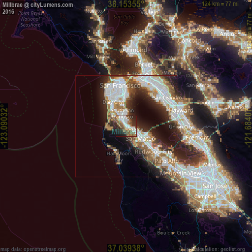
Analysis of Millbrae night lights 2016
Square area 10x10 km:
 14.8%
14.8%90-99
12.07%80-89
1.36%70-79
7.31%60-69
7.65%50-59
13.78%40-49
10.2%30-39
5.61%20-29
17.35%10-19
9.52%0-9
0.34%Square area 50x50 km:
8.84%90-99
7.35%80-89
1.64%70-79
3.7%60-69
4.21%50-59
4.49%40-49
3.99%30-39
3.63%20-29
7.43%10-19
9.7%0-9
45.03%Clear (daylight) street map image can be seen on geolist.org.
Map coordinates:
38° 9' 12.8" North, 123° 5' 25.2" West
37° 35' 54.8" North, 122° 23' 13.9" West
37° 2' 21.8" North, 121° 41' 2.7" West
Some cities around Millbrae sort by population:
• San Mateo
6.7 km =4.2 mi,  126°
126°
• South San Francisco
6.5 km =4 mi,  343°
343°
• San Bruno
4.1 km =2.5 mi,  329°
329°
• Pacifica
8.9 km =5.5 mi,  280°
280°
• Foster City
11.2 km =7 mi,  113°
113°
• Burlingame
2.5 km =1.6 mi, 130°
• Hillsborough
2.8 km =1.7 mi,  165°
165°
• El Granada
12.9 km =8 mi,  214°
214°
5373129 (p: 22,795)
Sources (retrieved 2019-11-25):
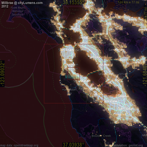
» Earth at Night: Flat Maps 2012, 2016