La Verne night lights from space
Night Light of La Verne (California) from space (United States) Src. Average luminocity for 10x10km area is 84.2601% and for 50x50km: 54.6357%.
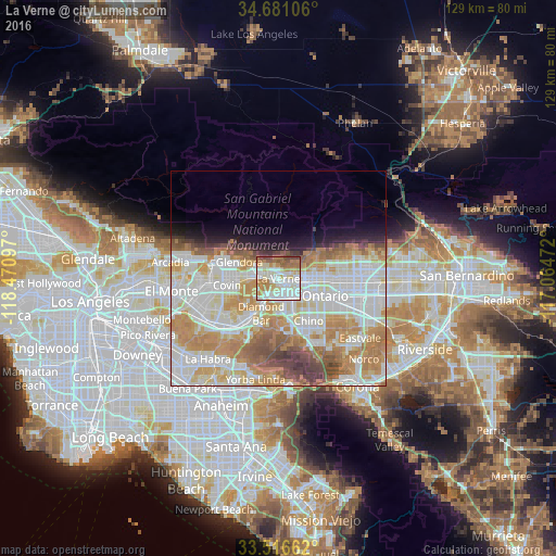
Analysis of La Verne night lights 2016
Square area 10x10 km:
 24.73%
90-99
27.47%80-89
12.09%70-79
8.61%60-69
17.4%50-59
6.41%40-49
3.3%30-39
0%20-29
0%10-19
0%0-9
0%Square area 50x50 km:
16.08%90-99
14.87%80-89
5.9%70-79
9.51%60-69
9.48%50-59
4.25%40-49
3.6%30-39
1.94%20-29
2.05%10-19
3.97%0-9
28.34%Clear (daylight) street map image can be seen on geolist.org.
Map coordinates:
34° 40' 51.8" North, 118° 28' 15.5" West
34° 6' 3" North, 117° 46' 4.2" West
33° 30' 59.8" North, 117° 3' 53" West
Some cities around La Verne sort by population:
• Pomona
5.3 km =3.3 mi,  164°
164°
• Upland
11 km =6.8 mi,  91°
91°
• Diamond Bar
8.9 km =5.5 mi,  205°
205°
• Glendora
9.8 km =6.1 mi,  293°
293°
• Montclair
7.6 km =4.7 mi,  109°
109°
• Claremont
4.4 km =2.7 mi,  95°
95°
• San Dimas
3.6 km =2.2 mi,  280°
280°
• Charter Oak
7.2 km =4.5 mi,  271°
271°
5364134 (p: 32,681)
Sources (retrieved 2019-11-25):
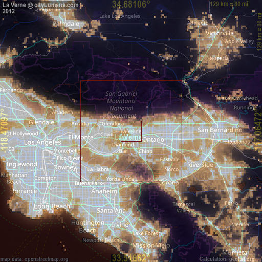
» Earth at Night: Flat Maps 2012, 2016