Ruston night lights from space
Night Light of Ruston (Louisiana) from space (United States) Src. Average luminocity for 10x10km area is 53.3553% and for 50x50km: 4.7334%.
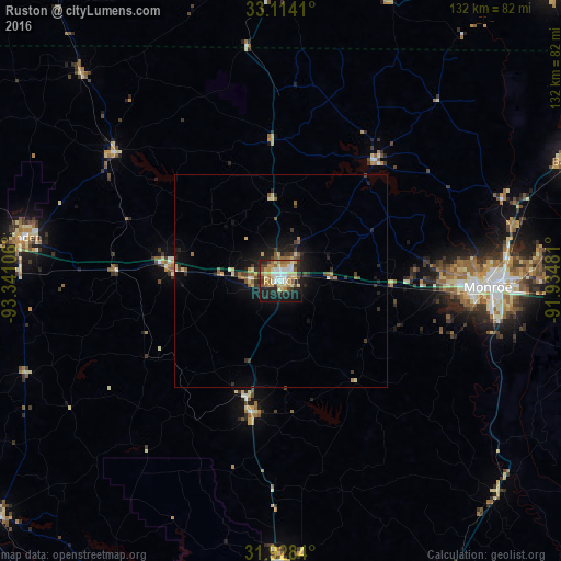

Analysis of Ruston night lights 2016
Square area 10x10 km:
 7.51%
7.51%90-99
10.81%80-89
11.72%70-79
8.97%60-69
8.42%50-59
4.95%40-49
2.75%30-39
9.71%20-29
14.29%10-19
18.86%0-9
2.01%Square area 50x50 km:
0.32%90-99
0.59%80-89
0.81%70-79
0.55%60-69
0.65%50-59
0.72%40-49
0.49%30-39
0.93%20-29
1.39%10-19
3.5%0-9
90.04%Clear (daylight) street map image can be seen on geolist.org.
Map coordinates:
33° 6' 50.8" North, 93° 20' 27.8" West
32° 31' 23.6" North, 92° 38' 16.5" West
31° 55' 42.2" North, 91° 56' 5.3" West
Some cities around Ruston sort by population:
• Monroe
48.7 km =30.3 mi,  91°
91°
• El Dorado
76.1 km =47.3 mi,  358°
358°
• West Monroe
46 km =28.6 mi, 90°
• Minden
61.7 km =38.3 mi,  279°
279°
• Claiborne
41.8 km =26 mi, 91°
• Bastrop
73.7 km =45.8 mi,  67°
67°
• Red Chute
91.5 km =56.9 mi,  272°
272°
• Grambling
7.2 km =4.5 mi, 273°
4339348 (p: 22,340)
Sources (retrieved 2019-11-25):
» Earth at Night: Flat Maps 2012, 2016