West Monroe night lights from space
Night Light of West Monroe (Louisiana) from space (United States) Src. Average luminocity for 10x10km area is 82.1868% and for 50x50km: 12.2243%.
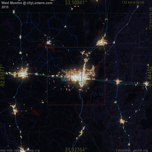
Analysis of West Monroe night lights 2016
Square area 10x10 km:
 24.18%
90-99
22.34%80-89
14.47%70-79
8.97%60-69
16.12%50-59
9.52%40-49
2.2%30-39
1.28%20-29
0.92%10-19
0%0-9
0%Square area 50x50 km:
1.67%90-99
1.81%80-89
1.69%70-79
1.19%60-69
2.04%50-59
2.04%40-49
1.77%30-39
2.09%20-29
3.61%10-19
6.61%0-9
75.49%Clear (daylight) street map image can be seen on geolist.org.
Map coordinates:
33° 6' 33.9" North, 92° 51' 2.8" West
32° 31' 6.5" North, 92° 8' 51.5" West
31° 55' 25.1" North, 91° 26' 40.3" West
Some cities around West Monroe sort by population:
• Monroe
2.8 km =1.7 mi,  110°
110°
• Ruston
46 km =28.6 mi,  270°
270°
• El Dorado
90.7 km =56.4 mi,  327°
327°
• Claiborne
4.1 km =2.5 mi, 266°
• Bastrop
36.4 km =22.6 mi,  37°
37°
• Tallulah
91 km =56.5 mi,  97°
97°
• Crossett
70 km =43.5 mi,  14°
14°
• Grambling
53.1 km =33 mi, 271°
4345850 (p: 12,966)
Sources (retrieved 2019-11-25):
» Earth at Night: Flat Maps 2012, 2016