Round Lake Park night lights from space
Night Light of Round Lake Park (Illinois) from space (United States) Src. Average luminocity for 10x10km area is 63.1079% and for 50x50km: 49.8891%.
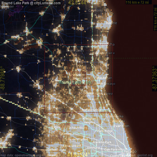
Analysis of Round Lake Park night lights 2016
Square area 10x10 km:
 4.13%
4.13%90-99
7.62%80-89
9.84%70-79
12.54%60-69
16.19%50-59
24.76%40-49
13.17%30-39
10.95%20-29
0.79%10-19
0%0-9
0%Square area 50x50 km:
5.99%90-99
6.79%80-89
5.88%70-79
7.17%60-69
12.21%50-59
13.22%40-49
11.29%30-39
7.58%20-29
8.86%10-19
11.37%0-9
9.65%Clear (daylight) street map image can be seen on geolist.org.
Map coordinates:
42° 52' 27.8" North, 88° 46' 47.6" West
42° 21' 25.1" North, 88° 4' 36.3" West
41° 50' 6.9" North, 87° 22' 25.1" West
Some cities around Round Lake Park sort by population:
• Mundelein
12 km =7.5 mi,  150°
150°
• Grayslake
3.2 km =2 mi,  115°
115°
• Lindenhurst
7.3 km =4.5 mi,  34°
34°
• Fox Lake
9.8 km =6.1 mi,  296°
296°
• Gages Lake
7.8 km =4.8 mi,  94°
94°
• Lake Villa
6.7 km =4.2 mi,  1°
1°
• Lakemoor
10.5 km =6.5 mi,  252°
252°
• Grandwood Park
8.4 km =5.2 mi,  61°
61°
4908243 (p: 7,426)
Sources (retrieved 2019-11-25):
» Earth at Night: Flat Maps 2012, 2016