Roseville night lights from space
Night Light of Roseville (California) from space (United States) Src. Average luminocity for 10x10km area is 90.1003% and for 50x50km: 38.3943%.
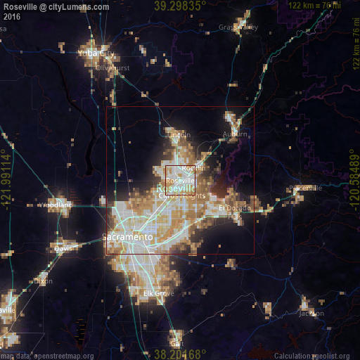
Analysis of Roseville night lights 2016
Square area 10x10 km:
 31.97%
90-99
30.61%80-89
10.88%70-79
20.07%60-69
6.46%50-59
0%40-49
0%30-39
0%20-29
0%10-19
0%0-9
0%Square area 50x50 km:
8.51%90-99
9.41%80-89
4.52%70-79
6.87%60-69
5.65%50-59
4.02%40-49
3.32%30-39
3.68%20-29
5%10-19
9.16%0-9
39.86%Clear (daylight) street map image can be seen on geolist.org.
Map coordinates:
39° 17' 54.1" North, 121° 59' 28.1" West
38° 45' 7.6" North, 121° 17' 16.8" West
38° 12' 6" North, 120° 35' 5.6" West
Some cities around Roseville sort by population:
• Citrus Heights
5 km =3.1 mi,  173°
173°
• Rocklin
6.2 km =3.9 mi,  46°
46°
• Antelope
6.1 km =3.8 mi,  216°
216°
• North Highlands
10.4 km =6.5 mi, 224°
• Orangevale
9.8 km =6.1 mi,  146°
146°
• Foothill Farms
9.8 km =6.1 mi,  213°
213°
• Granite Bay
10.8 km =6.7 mi,  83°
83°
• Loomis
11.3 km =7 mi, 46°
5388881 (p: 130,269)
Sources (retrieved 2019-11-25):
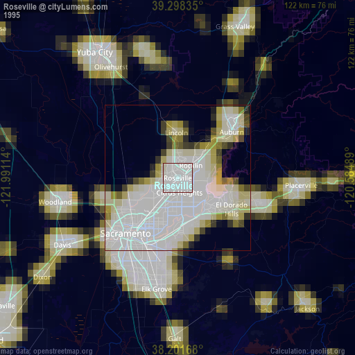
» NASA, Earths city lights 1995
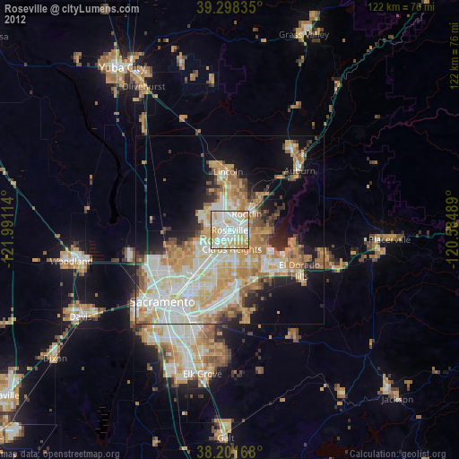
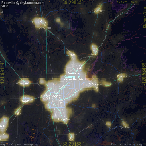
» NASA city lights 2003
» Earth at Night: Flat Maps 2012, 2016