Foothill Farms night lights from space
Night Light of Foothill Farms (California) from space (United States) Src. Average luminocity for 10x10km area is 88.8673% and for 50x50km: 43.3073%.
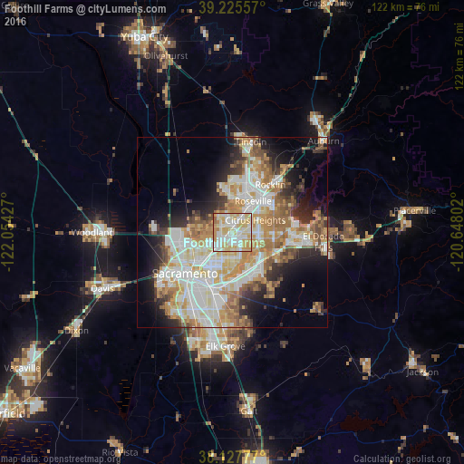

Analysis of Foothill Farms night lights 2016
Square area 10x10 km:
 24.83%
90-99
29.42%80-89
22.62%70-79
17.69%60-69
3.57%50-59
1.36%40-49
0.51%30-39
0%20-29
0%10-19
0%0-9
0%Square area 50x50 km:
9.91%90-99
10.94%80-89
5.12%70-79
7.71%60-69
6.31%50-59
4.33%40-49
3.55%30-39
3.83%20-29
5.95%10-19
8.78%0-9
33.56%Clear (daylight) street map image can be seen on geolist.org.
Map coordinates:
39° 13' 32.1" North, 122° 3' 15.4" West
38° 40' 43.6" North, 121° 21' 4.1" West
38° 7' 40" North, 120° 38' 52.9" West
Some cities around Foothill Farms sort by population:
• Roseville
9.8 km =6.1 mi,  33°
33°
• Arden-Arcade
8.8 km =5.5 mi,  195°
195°
• Citrus Heights
6.9 km =4.3 mi,  62°
62°
• Carmichael
7.1 km =4.4 mi,  163°
163°
• Antelope
3.8 km =2.4 mi, 29°
• North Highlands
2 km =1.2 mi,  293°
293°
• Fair Oaks
7.8 km =4.8 mi,  118°
118°
• Rio Linda
8.6 km =5.3 mi,  279°
279°
5349803 (p: 33,121)
Sources (retrieved 2019-11-25):
» Earth at Night: Flat Maps 2012, 2016