Loomis night lights from space
Night Light of Loomis (California) from space (United States) Src. Average luminocity for 10x10km area is 38.0085% and for 50x50km: 28.3025%.
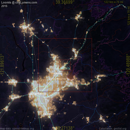
Analysis of Loomis night lights 2016
Square area 10x10 km:
 3.91%
3.91%90-99
3.57%80-89
2.21%70-79
7.65%60-69
9.69%50-59
6.29%40-49
6.8%30-39
10.88%20-29
11.73%10-19
20.41%0-9
16.84%Square area 50x50 km:
5.11%90-99
6.05%80-89
3.43%70-79
5.6%60-69
4.88%50-59
3.67%40-49
2.89%30-39
2.85%20-29
3.7%10-19
8.49%0-9
53.32%Clear (daylight) street map image can be seen on geolist.org.
Map coordinates:
39° 22' 1.2" North, 121° 53' 46.1" West
38° 49' 16.6" North, 121° 11' 34.8" West
38° 16' 17" North, 120° 29' 23.6" West
Some cities around Loomis sort by population:
• Roseville
11.3 km =7 mi,  226°
226°
• Citrus Heights
14.8 km =9.2 mi,  211°
211°
• Folsom
16 km =9.9 mi,  174°
174°
• Rocklin
5 km =3.1 mi, 227°
• Lincoln
11.7 km =7.3 mi,  312°
312°
• Granite Bay
6.9 km =4.3 mi,  158°
158°
• Auburn
13.1 km =8.1 mi,  50°
50°
• North Auburn
15.6 km =9.7 mi,  38°
38°
5368233 (p: 6,733)
Sources (retrieved 2019-11-25):
» Earth at Night: Flat Maps 2012, 2016