Tehachapi night lights from space
Night Light of Tehachapi (California) from space (United States) Src. Average luminocity for 10x10km area is 21.8899% and for 50x50km: 1.5293%.
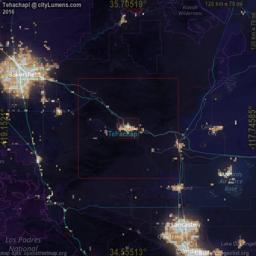
Analysis of Tehachapi night lights 2016
Square area 10x10 km:
 0.35%
0.35%90-99
1.05%80-89
1.57%70-79
6.12%60-69
6.29%50-59
5.07%40-49
4.55%30-39
1.57%20-29
1.92%10-19
13.46%0-9
58.04%Square area 50x50 km:
0.01%90-99
0.06%80-89
0.06%70-79
0.27%60-69
0.4%50-59
0.37%40-49
0.48%30-39
0.26%20-29
0.2%10-19
0.65%0-9
97.24%Clear (daylight) street map image can be seen on geolist.org.
Map coordinates:
35° 42' 18.7" North, 119° 9' 7.6" West
35° 7' 55.9" North, 118° 26' 56.3" West
34° 33' 18.5" North, 117° 44' 45.1" West
Some cities around Tehachapi sort by population:
• Lancaster
56 km =34.8 mi,  149°
149°
• Arvin
35.5 km =22.1 mi,  283°
283°
• Rosamond
39.6 km =24.6 mi,  138°
138°
• Lamont
44.6 km =27.7 mi,  288°
288°
• California City
42.1 km =26.2 mi,  90°
90°
• Quartz Hill
58.1 km =36.1 mi,  158°
158°
• Golden Hills
3.9 km =2.4 mi, 286°
• Bear Valley Springs
16.6 km =10.3 mi, 280°
5401297 (p: 13,021)
Sources (retrieved 2019-11-25):
» Earth at Night: Flat Maps 2012, 2016