Winterville night lights from space
Night Light of Winterville (North Carolina) from space (United States) Src. Average luminocity for 10x10km area is 60.9249% and for 50x50km: 15.7777%.
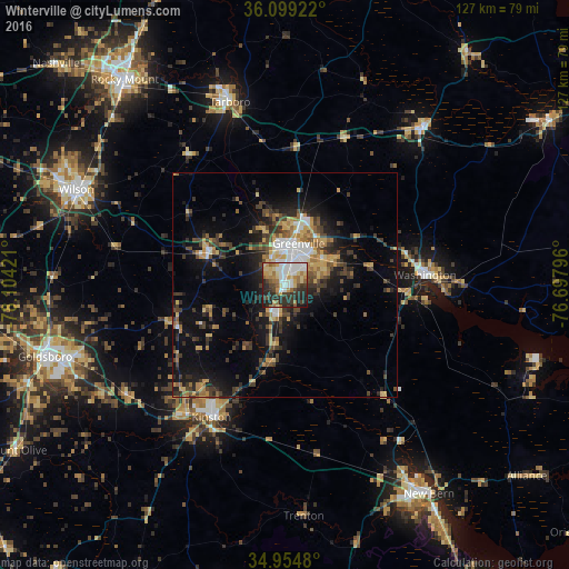
Analysis of Winterville night lights 2016
Square area 10x10 km:
 13.19%
90-99
10.81%80-89
12.45%70-79
8.06%60-69
9.71%50-59
5.49%40-49
5.13%30-39
9.71%20-29
21.25%10-19
4.21%0-9
0%Square area 50x50 km:
1.56%90-99
1.72%80-89
2.18%70-79
2.45%60-69
2.25%50-59
1.56%40-49
3.12%30-39
4.04%20-29
4.41%10-19
9.58%0-9
67.13%Clear (daylight) street map image can be seen on geolist.org.
Map coordinates:
36° 5' 57.2" North, 78° 6' 15.2" West
35° 31' 44.6" North, 77° 24' 3.9" West
34° 57' 17.3" North, 76° 41' 52.7" West
Some cities around Winterville sort by population:
• Greenville
9.8 km =6.1 mi,  18°
18°
• Wilson
51.2 km =31.8 mi,  294°
294°
• Goldsboro
55.9 km =34.7 mi,  253°
253°
• Kinston
33.8 km =21 mi,  208°
208°
• Tarboro
42.7 km =26.5 mi,  343°
343°
• Washington
31.6 km =19.6 mi,  86°
86°
• Williamston
47.8 km =29.7 mi,  40°
40°
• Ayden
6.4 km =4 mi,  191°
191°
4499629 (p: 9,464)
Sources (retrieved 2019-11-25):
» Earth at Night: Flat Maps 2012, 2016