Rock Springs night lights from space
Night Light of Rock Springs (Wyoming) from space (United States) Src. Average luminocity for 10x10km area is 32.9107% and for 50x50km: 3.2402%.

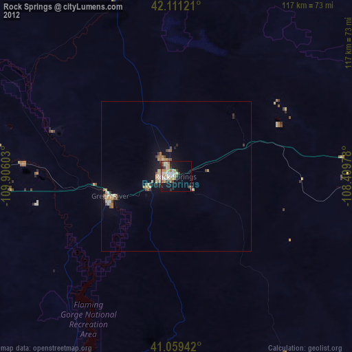
Analysis of Rock Springs night lights 2016
Square area 10x10 km:
 6.49%
6.49%90-99
7.95%80-89
3.9%70-79
4.06%60-69
2.76%50-59
4.22%40-49
1.62%30-39
4.22%20-29
8.44%10-19
21.27%0-9
35.06%Square area 50x50 km:
0.4%90-99
0.46%80-89
0.48%70-79
0.41%60-69
0.38%50-59
0.49%40-49
0.3%30-39
0.33%20-29
0.64%10-19
2.75%0-9
93.37%Clear (daylight) street map image can be seen on geolist.org.
Map coordinates:
42° 6' 40.4" North, 109° 54' 21.7" West
41° 35' 14.9" North, 109° 12' 10.4" West
41° 3' 33.9" North, 108° 29' 59.2" West
Some cities around Rock Springs sort by population:
• Green River
22.9 km =14.2 mi,  253°
253°
• Evanston
151 km =93.8 mi,  256°
256°
• Vernal
128.8 km =80 mi,  192°
192°
• Riverton
173.6 km =107.9 mi,  22°
22°
• Rawlins
164.7 km =102.3 mi,  82°
82°
• Craig
183 km =113.7 mi,  130°
130°
• Lander
143.8 km =89.4 mi, 15°
• Roosevelt
157.7 km =98 mi,  204°
204°
5836898 (p: 23,962)
Sources (retrieved 2019-11-25):
» Earth at Night: Flat Maps 2012, 2016