Green River night lights from space
Night Light of Green River (Wyoming) from space (United States) Src. Average luminocity for 10x10km area is 18.8741% and for 50x50km: 3.2529%.
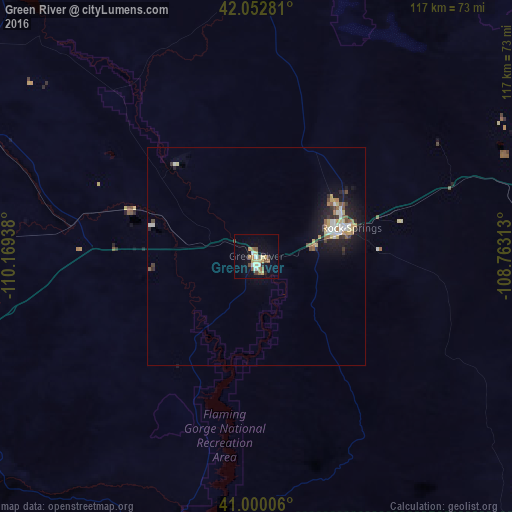
Analysis of Green River night lights 2016
Square area 10x10 km:
 1.7%
1.7%90-99
2.21%80-89
3.57%70-79
2.72%60-69
3.91%50-59
2.72%40-49
2.21%30-39
1.36%20-29
1.02%10-19
9.52%0-9
69.05%Square area 50x50 km:
0.41%90-99
0.49%80-89
0.45%70-79
0.4%60-69
0.35%50-59
0.48%40-49
0.29%30-39
0.4%20-29
0.68%10-19
2.71%0-9
93.34%Clear (daylight) street map image can be seen on geolist.org.
Map coordinates:
42° 3' 10.1" North, 110° 10' 9.8" West
41° 31' 42.9" North, 109° 27' 58.5" West
41° 0' 0.2" North, 108° 45' 47.3" West
Some cities around Green River sort by population:
• Rock Springs
22.9 km =14.2 mi,  73°
73°
• Evanston
128.2 km =79.7 mi,  256°
256°
• Vernal
119.4 km =74.2 mi,  182°
182°
• Riverton
188.9 km =117.4 mi,  28°
28°
• North Logan
196.1 km =121.9 mi,  277°
277°
• Rawlins
187.3 km =116.4 mi,  81°
81°
• Lander
157.2 km =97.7 mi,  22°
22°
• Roosevelt
143.5 km =89.2 mi,  197°
197°
5826559 (p: 12,465)
Sources (retrieved 2019-11-25):
» Earth at Night: Flat Maps 2012, 2016