Belvidere night lights from space
Night Light of Belvidere (Illinois) from space (United States) Src. Average luminocity for 10x10km area is 45.2409% and for 50x50km: 18.8431%.
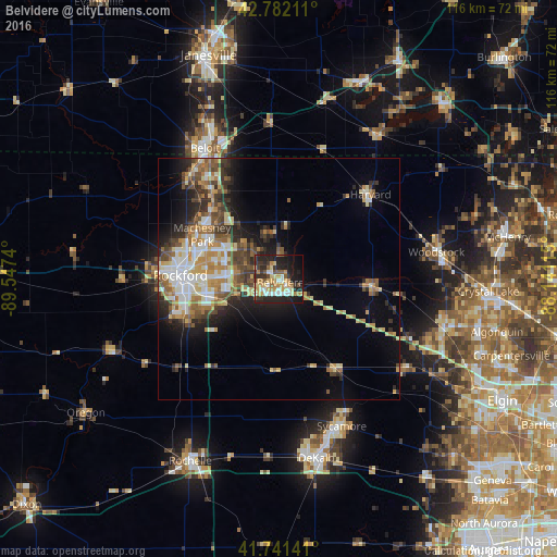
Analysis of Belvidere night lights 2016
Square area 10x10 km:
 6.82%
6.82%90-99
5.91%80-89
7.58%70-79
10%60-69
6.21%50-59
4.7%40-49
3.33%30-39
7.88%20-29
20.76%10-19
20.45%0-9
6.36%Square area 50x50 km:
2.5%90-99
3.24%80-89
2.71%70-79
2.83%60-69
2.89%50-59
2.7%40-49
2.75%30-39
2.83%20-29
4.46%10-19
7.06%0-9
66.03%Clear (daylight) street map image can be seen on geolist.org.
Map coordinates:
42° 46' 55.6" North, 89° 32' 50.6" West
42° 15' 50.1" North, 88° 50' 39.4" West
41° 44' 29.1" North, 88° 8' 28.1" West
Some cities around Belvidere sort by population:
• Rockford
20.6 km =12.8 mi,  272°
272°
• Loves Park
18.7 km =11.6 mi,  289°
289°
• Machesney Park
18.5 km =11.5 mi,  300°
300°
• Roscoe
21.4 km =13.3 mi,  320°
320°
• Harvard
25.9 km =16.1 mi,  47°
47°
• Marengo
19.5 km =12.1 mi,  95°
95°
• Genoa
22.3 km =13.9 mi,  146°
146°
• Poplar Grove
11.8 km =7.3 mi,  8°
8°
4884453 (p: 25,132)
Sources (retrieved 2019-11-25):
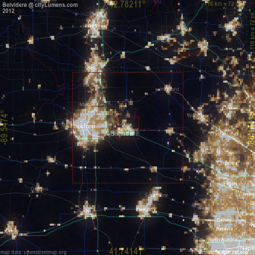
» Earth at Night: Flat Maps 2012, 2016