Roanoke night lights from space
Night Light of Roanoke (Texas) from space (United States) Src. Average luminocity for 10x10km area is 72.2894% and for 50x50km: 61.4916%.
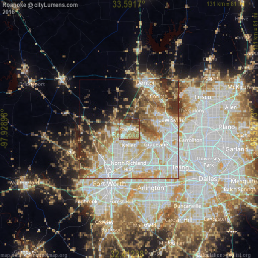
Analysis of Roanoke night lights 2016
Square area 10x10 km:
 13.55%
90-99
13%80-89
13.37%70-79
15.75%60-69
20.33%50-59
6.96%40-49
6.78%30-39
9.71%20-29
0.55%10-19
0%0-9
0%Square area 50x50 km:
15.74%90-99
15.67%80-89
10.04%70-79
8.59%60-69
8.06%50-59
7.1%40-49
5.4%30-39
4.99%20-29
6.06%10-19
4.69%0-9
13.67%Clear (daylight) street map image can be seen on geolist.org.
Map coordinates:
33° 35' 30.1" North, 97° 55' 44.3" West
33° 0' 14.4" North, 97° 13' 33.1" West
32° 24' 44.6" North, 96° 31' 21.8" West
Some cities around Roanoke sort by population:
• Flower Mound
12.1 km =7.5 mi,  84°
84°
• Grapevine
15.8 km =9.8 mi,  119°
119°
• Keller
8.1 km =5 mi,  197°
197°
• Southlake
11 km =6.8 mi,  129°
129°
• Colleyville
15.2 km =9.4 mi,  154°
154°
• Watauga
16.5 km =10.3 mi,  189°
189°
• Trophy Club
4 km =2.5 mi,  99°
99°
• Lantana
13.5 km =8.4 mi,  44°
44°
4723024 (p: 7,400)
Sources (retrieved 2019-11-25):
» Earth at Night: Flat Maps 2012, 2016