Flower Mound night lights from space
Night Light of Flower Mound (Texas) from space (United States) Src. Average luminocity for 10x10km area is 67.5916% and for 50x50km: 73.4623%.
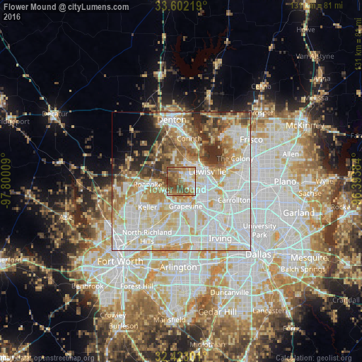
Analysis of Flower Mound night lights 2016
Square area 10x10 km:
 8.97%
8.97%90-99
10.99%80-89
5.49%70-79
14.47%60-69
19.23%50-59
24.73%40-49
9.89%30-39
6.23%20-29
0%10-19
0%0-9
0%Square area 50x50 km:
23.33%90-99
21.69%80-89
10.87%70-79
8.51%60-69
7.57%50-59
6.31%40-49
4.69%30-39
4.4%20-29
3.99%10-19
2.94%0-9
5.72%Clear (daylight) street map image can be seen on geolist.org.
Map coordinates:
33° 36' 7.9" North, 97° 48' 0.3" West
33° 0' 52.5" North, 97° 5' 49.1" West
32° 25' 22.8" North, 96° 23' 37.8" West
Some cities around Flower Mound sort by population:
• Lewisville
10.2 km =6.3 mi,  69°
69°
• Grapevine
9.1 km =5.7 mi,  168°
168°
• Coppell
10.1 km =6.3 mi,  131°
131°
• Southlake
8.9 km =5.5 mi,  203°
203°
• Highland Village
9.8 km =6.1 mi,  28°
28°
• Trophy Club
8.3 km =5.2 mi,  257°
257°
• Roanoke
12.1 km =7.5 mi, 264°
• Lantana
8.8 km =5.5 mi,  343°
343°
4691585 (p: 71,253)
Sources (retrieved 2019-11-25):
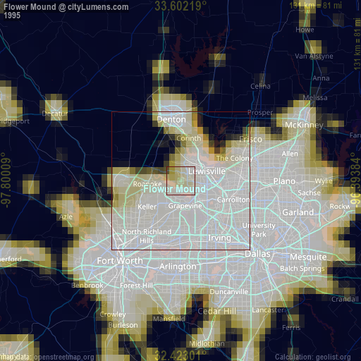
» NASA, Earths city lights 1995
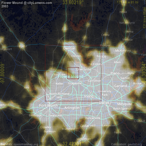
» NASA city lights 2003
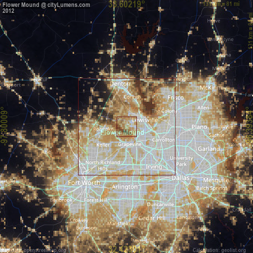
» Earth at Night: Flat Maps 2012, 2016