Randallstown night lights from space
Night Light of Randallstown (Maryland) from space (United States) Src. Average luminocity for 10x10km area is 73.6956% and for 50x50km: 52.3089%.
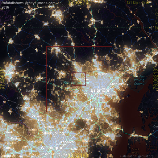
Analysis of Randallstown night lights 2016
Square area 10x10 km:
 19.56%
90-99
21.09%80-89
9.35%70-79
8.33%60-69
5.78%50-59
12.24%40-49
13.44%30-39
8.16%20-29
2.04%10-19
0%0-9
0%Square area 50x50 km:
16.29%90-99
11.52%80-89
5.15%70-79
6.63%60-69
6.36%50-59
5.72%40-49
4.76%30-39
5.61%20-29
7.08%10-19
12.88%0-9
18%Clear (daylight) street map image can be seen on geolist.org.
Map coordinates:
39° 54' 31.6" North, 77° 29' 54.2" West
39° 22' 2.4" North, 76° 47' 42.9" West
38° 49' 17.9" North, 76° 5' 31.7" West
Some cities around Randallstown sort by population:
• Ellicott City
11.1 km =6.9 mi,  181°
181°
• Woodlawn
7.6 km =4.7 mi,  130°
130°
• Pikesville
6.3 km =3.9 mi,  82°
82°
• Owings Mills
5.9 km =3.7 mi,  12°
12°
• Milford Mill
3.1 km =1.9 mi, 134°
• Reisterstown
11.8 km =7.3 mi,  344°
344°
• Lochearn
6.9 km =4.3 mi,  115°
115°
• Garrison
5.2 km =3.2 mi,  34°
34°
4366476 (p: 32,430)
Sources (retrieved 2019-11-25):
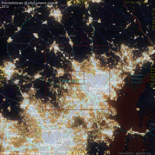
» Earth at Night: Flat Maps 2012, 2016