Garrison night lights from space
Night Light of Garrison (Maryland) from space (United States) Src. Average luminocity for 10x10km area is 82.301% and for 50x50km: 49.7244%.
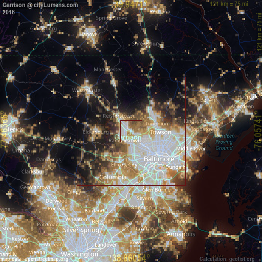
Analysis of Garrison night lights 2016
Square area 10x10 km:
 25.34%
90-99
24.83%80-89
12.41%70-79
6.63%60-69
13.44%50-59
11.05%40-49
5.44%30-39
0.85%20-29
0%10-19
0%0-9
0%Square area 50x50 km:
15.54%90-99
10.67%80-89
4.94%70-79
5.91%60-69
5.97%50-59
5.36%40-49
4.5%30-39
5.88%20-29
7.02%10-19
14.22%0-9
20%Clear (daylight) street map image can be seen on geolist.org.
Map coordinates:
39° 56' 49.6" North, 77° 27' 49.2" West
39° 24' 21.4" North, 76° 45' 37.9" West
38° 51' 37.9" North, 76° 3' 26.7" West
Some cities around Garrison sort by population:
• Woodlawn
9.6 km =6 mi,  163°
163°
• Randallstown
5.2 km =3.2 mi,  214°
214°
• Pikesville
4.8 km =3 mi,  137°
137°
• Owings Mills
2.3 km =1.4 mi,  311°
311°
• Milford Mill
6.5 km =4 mi,  187°
187°
• Reisterstown
9.4 km =5.8 mi,  319°
319°
• Lochearn
8 km =5 mi, 155°
• Mays Chapel
10 km =6.2 mi,  72°
72°
4355958 (p: 8,823)
Sources (retrieved 2019-11-25):
» Earth at Night: Flat Maps 2012, 2016