Lochearn night lights from space
Night Light of Lochearn (Maryland) from space (United States) Src. Average luminocity for 10x10km area is 96.3146% and for 50x50km: 60.3087%.
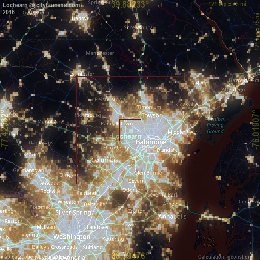
Analysis of Lochearn night lights 2016
Square area 10x10 km:
 45.58%
90-99
40.82%80-89
7.48%70-79
5.44%60-69
0.68%50-59
0%40-49
0%30-39
0%20-29
0%10-19
0%0-9
0%Square area 50x50 km:
18.56%90-99
13.97%80-89
6.65%70-79
7.94%60-69
7.26%50-59
6.3%40-49
5.32%30-39
6.12%20-29
7.53%10-19
13.25%0-9
7.1%Clear (daylight) street map image can be seen on geolist.org.
Map coordinates:
39° 52' 56.4" North, 77° 25' 31.2" West
39° 20' 26.4" North, 76° 43' 19.9" West
38° 47' 41.1" North, 76° 1' 8.7" West
Some cities around Lochearn sort by population:
• Catonsville
7.7 km =4.8 mi,  186°
186°
• Woodlawn
2 km =1.2 mi, 194°
• Randallstown
6.9 km =4.3 mi,  295°
295°
• Pikesville
3.7 km =2.3 mi,  359°
359°
• Milford Mill
4.2 km =2.6 mi,  281°
281°
• Arbutus
9.8 km =6.1 mi,  168°
168°
• Garrison
8 km =5 mi,  335°
335°
• Charles Village
9.6 km =6 mi,  101°
101°
4360954 (p: 25,333)
Sources (retrieved 2019-11-25):
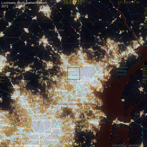
» Earth at Night: Flat Maps 2012, 2016