Ellicott City night lights from space
Night Light of Ellicott City (Maryland) from space (United States) Src. Average luminocity for 10x10km area is 76.7687% and for 50x50km: 64.8295%.
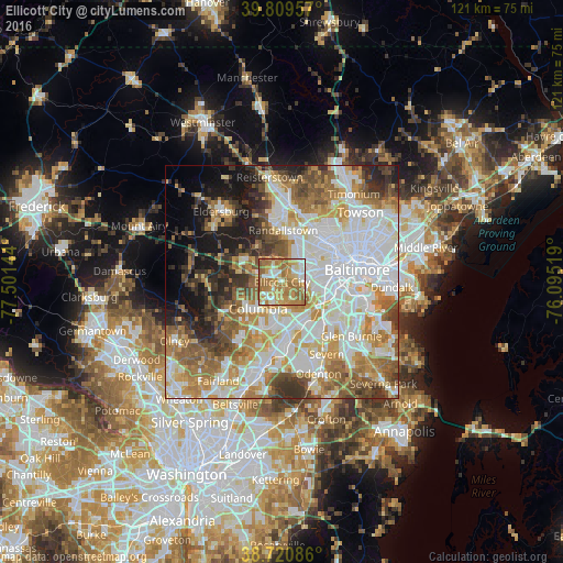
Analysis of Ellicott City night lights 2016
Square area 10x10 km:
 11.73%
90-99
13.95%80-89
11.05%70-79
23.3%60-69
32.14%50-59
7.82%40-49
0%30-39
0%20-29
0%10-19
0%0-9
0%Square area 50x50 km:
19.25%90-99
15.35%80-89
7.16%70-79
9.32%60-69
9.43%50-59
8.32%40-49
5.43%30-39
5.57%20-29
5.47%10-19
7.92%0-9
6.78%Clear (daylight) street map image can be seen on geolist.org.
Map coordinates:
39° 48' 34.5" North, 77° 30' 5.2" West
39° 16' 2.4" North, 76° 47' 53.9" West
38° 43' 15.1" North, 76° 5' 42.7" West
Some cities around Ellicott City sort by population:
• Columbia
4.6 km =2.9 mi,  229°
229°
• Catonsville
5.7 km =3.5 mi,  84°
84°
• Woodlawn
8.6 km =5.3 mi,  44°
44°
• Milford Mill
9.3 km =5.8 mi,  15°
15°
• West Elkridge
9.1 km =5.7 mi,  137°
137°
• Ilchester
3.4 km =2.1 mi,  122°
122°
• Arbutus
8.6 km =5.3 mi,  99°
99°
• Elkridge
9.5 km =5.9 mi,  129°
129°
4354265 (p: 65,834)
Sources (retrieved 2019-11-25):
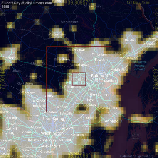
» NASA, Earths city lights 1995
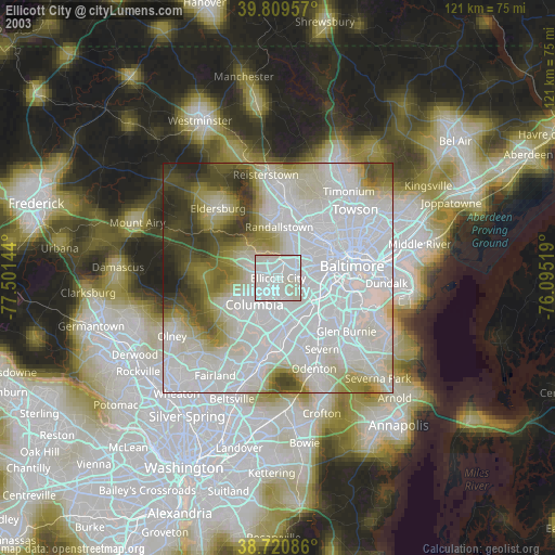
» NASA city lights 2003
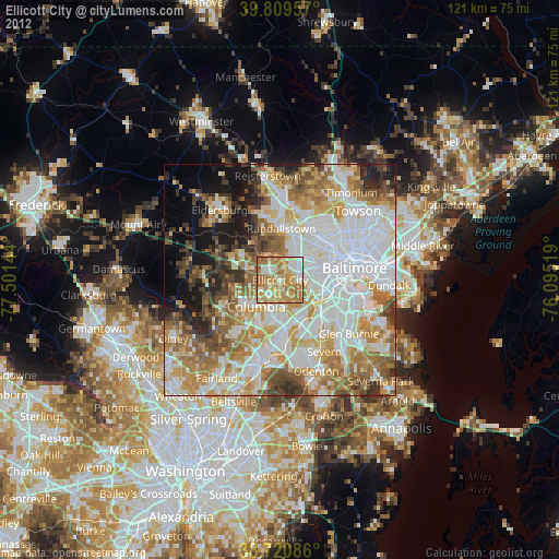
» Earth at Night: Flat Maps 2012, 2016