Rancho Santa Margarita night lights from space
Night Light of Rancho Santa Margarita (California) from space (United States) Src. Average luminocity for 10x10km area is 55.0916% and for 50x50km: 35.6223%.
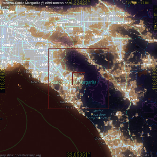
Analysis of Rancho Santa Margarita night lights 2016
Square area 10x10 km:
 4.4%
4.4%90-99
7.69%80-89
5.31%70-79
7.33%60-69
21.98%50-59
12.64%40-49
14.84%30-39
6.96%20-29
5.13%10-19
12.27%0-9
1.47%Square area 50x50 km:
6.8%90-99
6.24%80-89
2.96%70-79
4.59%60-69
8.6%50-59
6.88%40-49
5.36%30-39
4.08%20-29
5.66%10-19
11.94%0-9
36.89%Clear (daylight) street map image can be seen on geolist.org.
Map coordinates:
34° 13' 27.2" North, 118° 18' 22.4" West
33° 38' 27.1" North, 117° 36' 11.2" West
33° 3' 12.6" North, 116° 53' 59.9" West
Some cities around Rancho Santa Margarita sort by population:
• Mission Viejo
7.8 km =4.8 mi,  234°
234°
• Lake Forest
8 km =5 mi,  274°
274°
• Laguna Hills
10.6 km =6.6 mi,  252°
252°
• Ladera Ranch
8.3 km =5.2 mi,  201°
201°
• Coto De Caza
4.3 km =2.7 mi,  159°
159°
• Foothill Ranch
7.4 km =4.6 mi,  313°
313°
• Portola Hills
5 km =3.1 mi,  328°
328°
• Las Flores
6.3 km =3.9 mi, 200°
5386082 (p: 49,324)
Sources (retrieved 2019-11-25):
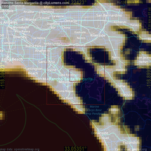
» NASA, Earths city lights 1995
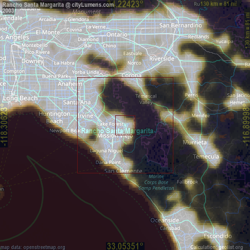
» NASA city lights 2003
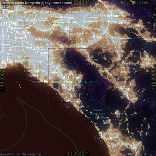
» Earth at Night: Flat Maps 2012, 2016