Foothill Ranch night lights from space
Night Light of Foothill Ranch (California) from space (United States) Src. Average luminocity for 10x10km area is 55.3462% and for 50x50km: 46.1173%.
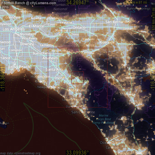
Analysis of Foothill Ranch night lights 2016
Square area 10x10 km:
 9.16%
9.16%90-99
9.71%80-89
6.78%70-79
8.06%60-69
10.07%50-59
14.84%40-49
8.79%30-39
5.31%20-29
12.64%10-19
10.99%0-9
3.66%Square area 50x50 km:
12.11%90-99
9.21%80-89
4.08%70-79
6.04%60-69
9.45%50-59
7.22%40-49
6.01%30-39
3.95%20-29
4.62%10-19
9.58%0-9
27.75%Clear (daylight) street map image can be seen on geolist.org.
Map coordinates:
34° 16' 10.1" North, 118° 21' 50.4" West
33° 41' 11.1" North, 117° 39' 39.2" West
33° 5' 57.7" North, 116° 57' 27.9" West
Some cities around Foothill Ranch sort by population:
• Mission Viejo
9.7 km =6 mi,  186°
186°
• Lake Forest
5.1 km =3.2 mi,  210°
210°
• Rancho Santa Margarita
7.4 km =4.6 mi,  133°
133°
• Laguna Hills
9.5 km =5.9 mi, 210°
• Laguna Woods
10.4 km =6.5 mi,  215°
215°
• Coto De Caza
11.4 km =7.1 mi,  143°
143°
• Portola Hills
2.9 km =1.8 mi,  106°
106°
• Las Flores
11.4 km =7.1 mi,  163°
163°
5349828 (p: 11,698)
Sources (retrieved 2019-11-25):
» Earth at Night: Flat Maps 2012, 2016