Rancho Palos Verdes night lights from space
Night Light of Rancho Palos Verdes (California) from space (United States) Src. Average luminocity for 10x10km area is 33.5916% and for 50x50km: 30.8474%.
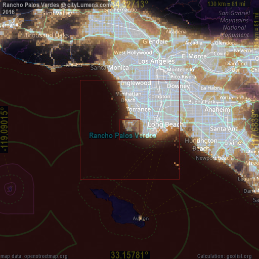
Analysis of Rancho Palos Verdes night lights 2016
Square area 10x10 km:
 0.37%
0.37%90-99
1.28%80-89
1.28%70-79
2.2%60-69
15.02%50-59
17.03%40-49
10.07%30-39
1.47%20-29
5.86%10-19
19.78%0-9
25.64%Square area 50x50 km:
19.58%90-99
6.06%80-89
0.58%70-79
0.68%60-69
1.62%50-59
1.7%40-49
1.37%30-39
1.27%20-29
2.2%10-19
3.65%0-9
61.29%Clear (daylight) street map image can be seen on geolist.org.
Map coordinates:
34° 19' 37.7" North, 119° 5' 24.5" West
33° 44' 40.1" North, 118° 23' 13.3" West
33° 9' 28.1" North, 117° 41' 2" West
Some cities around Rancho Palos Verdes sort by population:
• Torrance
11 km =6.8 mi,  22°
22°
• San Pedro
8.8 km =5.5 mi,  96°
96°
• Redondo Beach
11.6 km =7.2 mi,  359°
359°
• West Carson
12.2 km =7.6 mi,  45°
45°
• Lomita
8.5 km =5.3 mi, 51°
• Hermosa Beach
13.1 km =8.1 mi,  354°
354°
• Palos Verdes Estates
6.3 km =3.9 mi, 355°
• Rolling Hills Estates
5.5 km =3.4 mi,  28°
28°
5386035 (p: 42,732)
Sources (retrieved 2019-11-25):
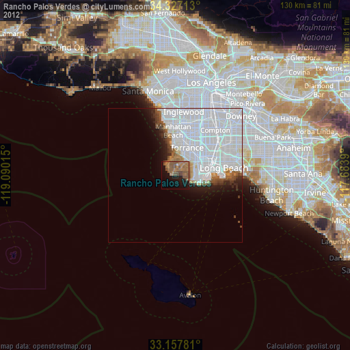
» Earth at Night: Flat Maps 2012, 2016