Hermosa Beach night lights from space
Night Light of Hermosa Beach (California) from space (United States) Src. Average luminocity for 10x10km area is 66.0769% and for 50x50km: 49.1499%.
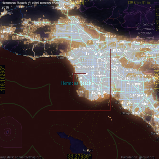
Analysis of Hermosa Beach night lights 2016
Square area 10x10 km:
 30.24%
90-99
21.5%80-89
1.92%70-79
1.05%60-69
2.8%50-59
2.8%40-49
2.8%30-39
7.87%20-29
13.81%10-19
11.19%0-9
4.02%Square area 50x50 km:
32.73%90-99
9.02%80-89
0.98%70-79
1.05%60-69
2.4%50-59
2.17%40-49
1.87%30-39
1.69%20-29
2.88%10-19
5.45%0-9
39.75%Clear (daylight) street map image can be seen on geolist.org.
Map coordinates:
34° 26' 38.8" North, 119° 6' 9.5" West
33° 51' 44.1" North, 118° 23' 58.3" West
33° 16' 35" North, 117° 41' 47" West
Some cities around Hermosa Beach sort by population:
• Torrance
6.2 km =3.9 mi,  118°
118°
• Redondo Beach
1.8 km =1.1 mi,  144°
144°
• Manhattan Beach
2.7 km =1.7 mi,  337°
337°
• Lawndale
5.1 km =3.2 mi,  57°
57°
• El Segundo
6.5 km =4 mi,  346°
346°
• Palos Verdes Estates
6.8 km =4.2 mi,  174°
174°
• Del Aire
6.6 km =4.1 mi,  24°
24°
• Alondra Park
7 km =4.3 mi, 64°
5356521 (p: 19,860)
Sources (retrieved 2019-11-25):
» Earth at Night: Flat Maps 2012, 2016