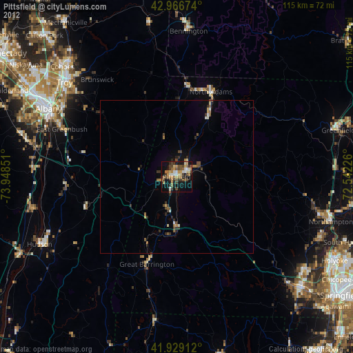
Pittsfield night lights from space
Night Light of Pittsfield (Massachusetts) from space (United States) Src. Average luminocity for 10x10km area is 38.6651% and for 50x50km: 3.2361%.

Analysis of Pittsfield night lights 2016
Square area 10x10 km:
 3.65%
3.65%90-99
5.4%80-89
6.67%70-79
3.97%60-69
3.97%50-59
7.14%40-49
11.11%30-39
8.57%20-29
9.21%10-19
29.84%0-9
10.48%Square area 50x50 km:
0.16%90-99
0.31%80-89
0.39%70-79
0.35%60-69
0.42%50-59
0.58%40-49
0.84%30-39
0.61%20-29
0.88%10-19
2.29%0-9
93.17%Clear (daylight) street map image can be seen on geolist.org.
Map coordinates:
42° 58' 0.3" North, 73° 56' 54.6" West
42° 27' 0.3" North, 73° 14' 43.4" West
41° 55' 44.8" North, 72° 32' 32.1" West
Some cities around Pittsfield sort by population:
• Albany
47.5 km =29.5 mi,  298°
298°
• Troy
47.9 km =29.8 mi,  310°
310°
• North Adams
30.1 km =18.7 mi,  21°
21°
• Watervliet
48.6 km =30.2 mi, 309°
• Rensselaer
46 km =28.6 mi, 297°
• Bennington
47.8 km =29.7 mi,  4°
4°
• Dalton
7 km =4.3 mi,  67°
67°
• Adams
22 km =13.7 mi,  28°
28°
4947459 (p: 43,303)
Sources (retrieved 2019-11-25):
» Earth at Night: Flat Maps 2012, 2016